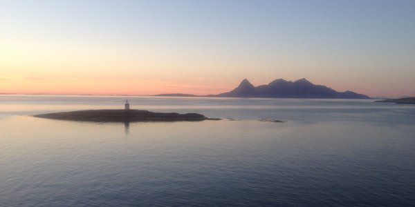
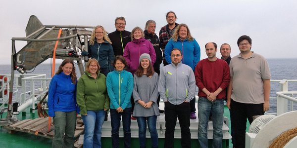
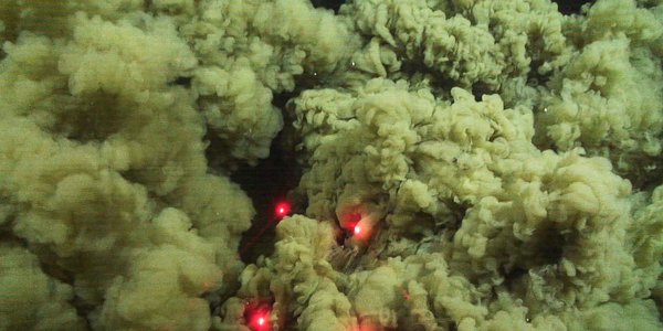
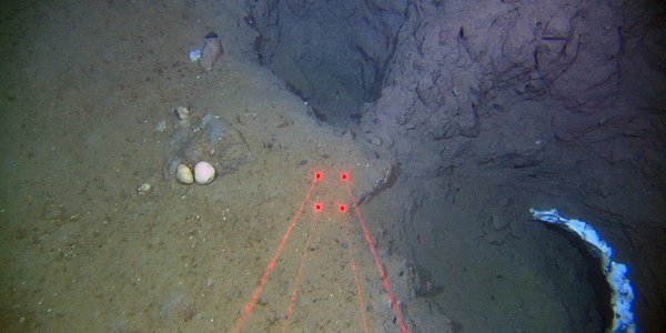
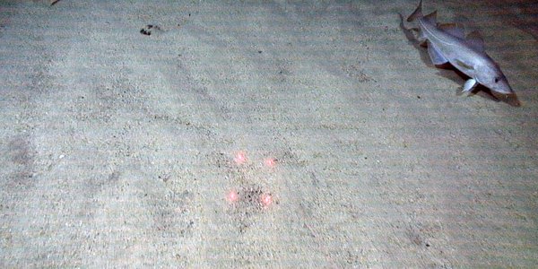
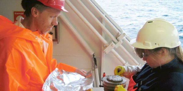
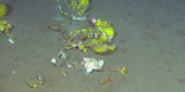
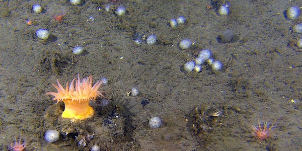
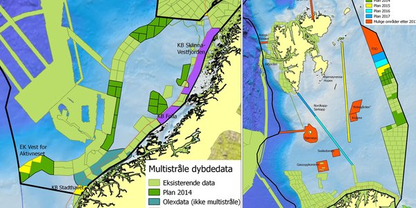
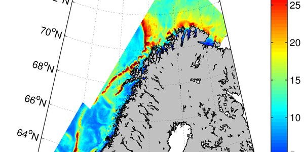
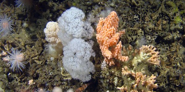
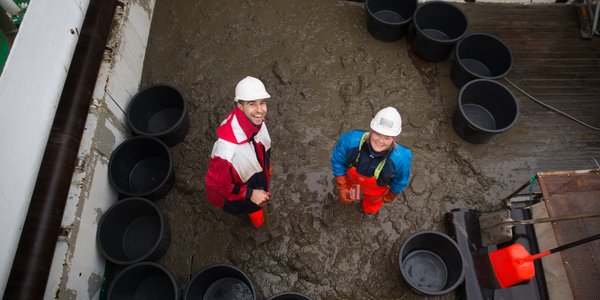
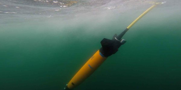
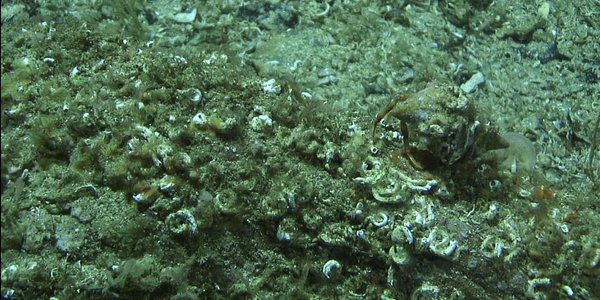
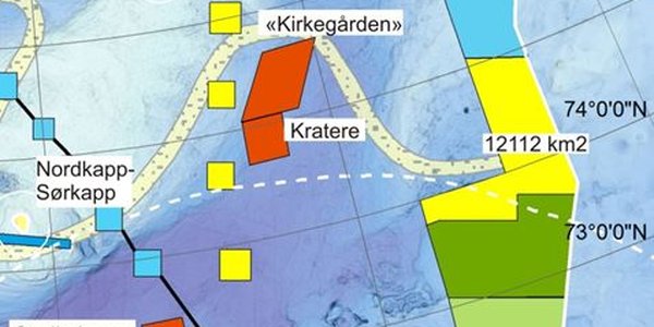
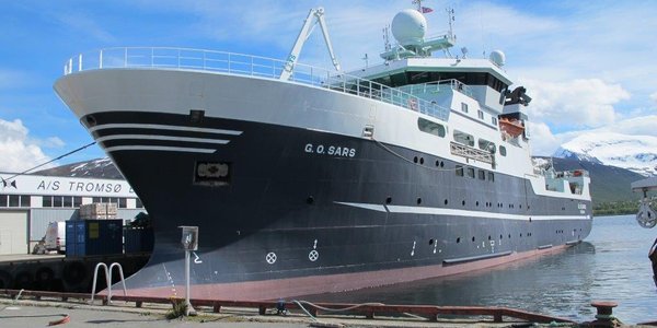
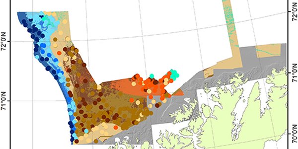
Goto main content

News

Result: (150) Showing 61 - 90

traalspor1

High production and intensive fisheries

23.06.2015

Cruise diary: Middle reaches of the Barents Sea are characterized by large mudflats which provide habitat for many exciting benthic species, and also provide clear evidence of destructive fishing activity. We have frequently observed cod, haddock, and some dead fish specimens. In some areas the seabed has been substantially altered by trawling activity.

GO Sars

MAREANO Spring Cruise — Mission Accomplished!

07.07.2015

Cruise diary: Yet another successful MAREANO cruise has been completed. After 14 days at sea, and a 40-hour return voyage from key regions of the Barents Sea, R/V G.O. Sars docked in Tromsø on Thursday morning (06/18/2015).

havedderkopper

The Barents Sea — high production and a rich species community

16.06.2015

Cruise diary: Despite large amounts of “marine snow” and a gel-like layer covering bottom sediments, the seafloor in central parts of the Barents Sea is teeming with life.  Here MAREANO is currently taking samples, and conducting video transects. Regardless of one day with stormy weather conditions, we remain on schedule.

hjelmen14 500

The Helmet – a tale of a salt pillar

15.06.2015

MAREANOs first video station of 2015 documented a conspicuous seabed structure, about 300 km north-northeast of mainland Norway, known as The Helmet. The circular structure which looks like the top of a helmet sticking out of the seabed is 30 m high and has a diameter of 800 m.

R1479VL1525 rec b  00 21 LBM

Deep sea snow storm in the Barents Sea

12.06.2015

Cruise diary: Now we are well underway with visual inspection and sampling of the seabed at this year’s first MAREANO cruise.

R1456 gul anemone

The Barents Sea surveys continue

15.06.2015

Cruise diary: MAREANO's first cruise of 2015 set sail from Tromsø last Friday bound for the new Norwegian area of the Barents Sea. Sixteen scientists and technicians will spend the next two weeks onboard the research vessel G.O. Sars, investigating one of the world's richest seas. The benthic environment and faunal communities over an area of 12 000 km2 is to be sampled while a total of 44 line kilometers across 60 sites will be filmed with high resolution video.

bilde 1

MAREANO cruises in 2015

05.06.2015

MAREANO’s 2015 geological, biological and chemical field sampling will take place at the shelf slope off mid-Norway in the Norwegian Sea, and in the Barents Sea along the Russian-Norwegian shelf border. Bathymetric data are being acquired in the Barents Sea along the Russian-Norwegian shelf border and patch-wise along a ca. 500 km long transect from Bjørnøyrenna to Kong Karls Land as well as at the shelf slope off mid-Norway and Stadhavet in the Norwegian Sea.

NorKyst800 UVmean 2010 web

Modelling of bottom currents

05.06.2015

The bottom currents have a large impact on the sea floor and the animals that live there. It is difficult to measure the bottom currents over large areas, but improved models have now opened up the ability to estimate the bottom currents at reasonable accuracy. In MAREANO, the results are used in mapping the nature types.

Blomk lkorall risengrynkora 500px

Surrounded by corals

05.06.2015

A number of different coral reefs have been discovered in waters off the Norwegian coast. The Røst Reef off Norway’s Lofoten Islands is the world's largest known Lophelia reef. That these corals almost encircle the entire North Atlantic is more unknown.

Barentshavet BB 230513 21

New Invitation to Tender for Bathymetric Survey

16.12.2014

MAREANO continues with bathymetric mapping in the Barents Sea in 2015. An open procedure of the tender competition for the procurement of Bathymetry data acquisition and processing for the MAREANO programme was published 8 December 2014.

biotope wholearea k8 top7 25pc x20 500

New biotope map for areas offshore Troms and Finnmark

04.11.2014

A new biotope map for the area including Troms III and the shelf edge to west Finnmark is now available on MAREANO's map service.

Bilde2

Another successful MAREANO cruise finished

05.09.2014

Cruise diary: MAREANO's last biology-geology-pollution mapping cruise this season is finished, and once more we have had good weather in the Barents Sea. Thus, we have finished all cruise activities that were planned for this year, in addition to making a small start on next year's tasks.

oppvirvlete bunnsedimenter

Biological postcards letter from Finnmark and the Barents Sea

04.09.2014

Cruise diary: This newsletter has been written by all the biologists onboard the G.O.Sars at the last biogy and geology cruise in 2014. Each biologist has picked her favourite photo from the work on this cruise, and they have written a story for that picture.  There are many different voices here, this reflects both the diversity we see in the benthic communities – and the diversity among the biologists.


Pic3 glider under vann seaexplorer

New glider in the Barents Sea

03.09.2014

Cruise diary: The Mareano 3 cruise also includes deployment of a new type of underwater glider - a 'SeaExplorer' - to complete a north-south transect of the Barents Sea. Two guests from the LOCEAN laboratory in Paris are on board the G.O. Sars for the deployment: glider engineer Michael Field and PhD student Laurent Oziel. The SeaExplorer was successfully deployed from the rescue boat on 2 September.

fig6

A mosaic of habitats on the Finnmark coast

01.09.2014

Cruise diary: 700 meters is almost as long as twice around a sport-field. It is also the length of one MAREANO video-transect. In some areas all 700 meters will look much the same, but other times we observe large variations along the line. This is the story about a transect with lots of changes.

underwater photo of seabed with laser marks

Peculiar holes in the seabed offshore Finnmark

28.08.2014

MAREANO video footage crossing a long, elongated cliff north of Varangerhalvøya has shown the presence of irregular holes in the seabed. Strange white features occur at the bottom of the holes and in two larger depressions.

undervannsfoto av skjellsand og sei

Shell sand found at several hundred metres water depth

25.08.2014

One unexpected finding as MAREANO completed data collection along the Finnmark coast has been the presence of shell sand at more than three hundred metres water depth, off Nordkapp.

mareanotokt 8055 2

The last MAREANO cruise this year has just started

21.08.2014

Cruise diary: This week marks the start of the third and last MAREANO cruise in 2014. Onboard R/V G.O. Sars, we find 16 enthusiastic researchers and technicians who are all ready to examine the seafloor of the Finnmark coast and the SE Norwegian part of the Barents Sea.

news august 1 500

Geological seabed mapping along the Finnmark coast, northern Norway

21.08.2014

Over the past five years MAREANO has conducted several mapping cruises along the coast of Finnmark. Starting in August 2014, the third and final MAREANO cruise of the year will map the remaining areas in the coastal belt, focusing on areas north of Sørøya, Magerøya and Nordkinnhalvøya.

R1364VL1407 still e 00 13 11

How to use the uw-camera

08.07.2014

The MAREANO cruise was undertaken to survey the sea floor at Storegga, Norwegian Sea. In order to achieve this we took a multitude of video stations coupled with a few beam trawls, RP nets, grabs and cores.

storegga1 ps cropv3 web norsk 500

The incredible world of Storegga

25.06.2014

Last autumn MAREANO scientists documented the geology and biology of the southern part of Storegga, which lies at the edge of the continental shelf in mid-Norway. Now we are back to complete the journey through this fascinating underwater landscape, armed with new multibeam data that complete the picture of the terrain on the shelf.

startbilde 500

Map service in new look

16.06.2014

A more updated look and easier navigation is the most visible changes in the new map service on www.mareano.no. With a few keystrokes, you can create your own maps based on interest.

R1315VL1354 rec still e 00 05 46 kongekrabbe 3

On their way to the depths

18.05.2014

VIDEO: During the MAREANO-survey April 13–26 a large number of king crabs were observed at about 40 m depth just off the village Berlevåg in the northernmost Norwegian county Finnmark. It is well-known that the king crab thrive in this area and was on its way towards deeper waters after a short trip to quite shallow depths where hatching, spawning and mating take place at this time of the year.

Eremittkreps med anemone

MAREANO mapping off the coast of Finnmark

24.04.2014

Cruise diary: Sunday April 13 at 13.30 we left Tromsø and have since conducted 26 video transects and six
sampling stations, where a suite of gears is used.

Blomkålkorall

Kartlegger på Finnmarkskysten

16.04.2014

Toktdagbok: Søndag 13. april kl. 13.30 la ”G.O. Sars” fra kai i Tromsø i et utrolig vakkert vær. Vår første stasjon var rett nord for Sørøya. Vi startet med videoopptak på 200 meters dyp ved midnatt, og observerte sandbunn med mye grus og stein hvor bunnforhold og bunndyr var lite variert.

Oversikt gjennomført og planlagt dybdekartlegging, 2014

MAREANO-surveys in 2014

08.04.2014

In its tenth year, MAREANO is to survey both the Norwegian and the Barents Sea. Bathymetric measurements in the Barents Sea have been undergoing since January along the Russian-Norwegian border while the 2014 start-up in the Norwegian Sea took place in March. The biological, geological and chemical sampling will start on April 13 off the coast of Finnmark and in the south-eastern part of the Barents Sea, and on June 16 in the Norwegian Sea, northeast of Mørebankene.

fig1

Carbonate crust revealed in pockmarks on the mid-Norwegian shelf

29.01.2014

Video footage acquired during MAREANOs latest cruise at Skoldryggen has revealed why the inside of pockmarks at 440 m depth on the seabed appear harder than the surrounding seabed, when seen on multibeam backscatter images. Carbonate crusts have been found at the bottom of the pockmarks (Figure 1).

Scalibregma hanseni

New polychaete species

23.01.2014

Once again, a polychaete species has been discovered in samples from a MAREANO survey. The new species has been named Scalibregma hanseni and was collected in subzero temperatures at 765 meter depth from the continental slope in the Norwegian Sea.

biotoper midnorsk sokkel web2

Biotopes of the mid-Norwegian continental shelf revealed by MAREANO

09.12.2013

A biotope map for the Norwegian Sea based on video data from MAREANO 2012 is now available on www.mareano.no. Biotopes are regions with similar communities of animals living on the seabed, in a similar physical environment. Maps such as these, which bring together the physical and biological attributes of the seabed, can provide particularly valuable information for sustainable management.

N6 webmap norsk web

Biotope map for Nordland VI published

05.12.2013

MAREANO scientists have now produced a biotope map for the Nordland VI area in Northern Norway. "Biotope" is a term used to describe the main biological communities and the physical environment they inhabit.  MAREANO video data were to determine the biological communities and this information was put together with bathymetry, terrain and geological data to model the overall distribution of biotopes.