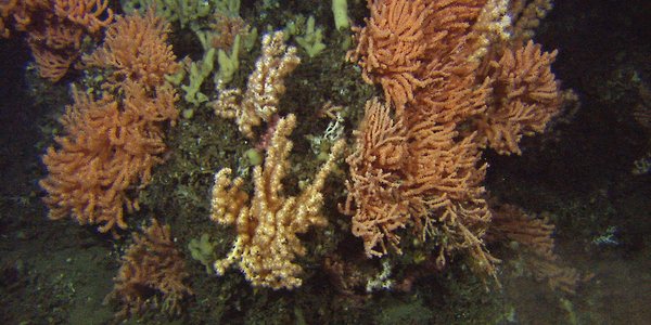
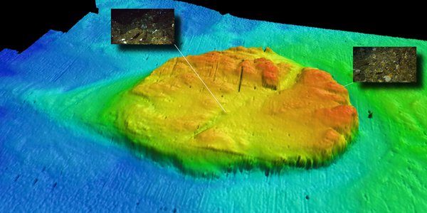
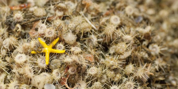
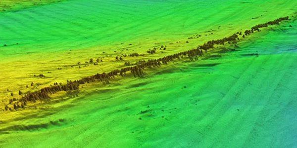
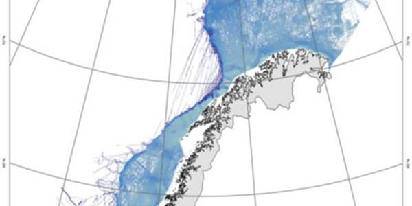
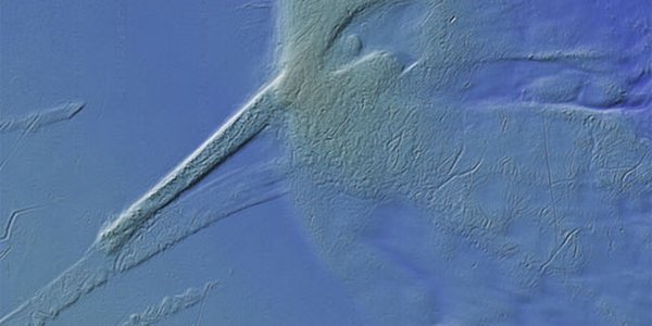
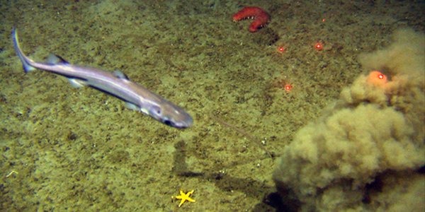
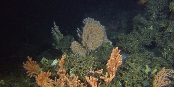
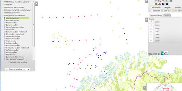
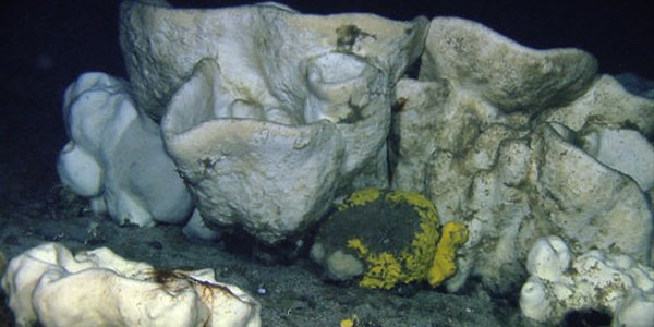
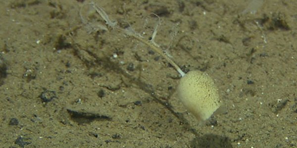
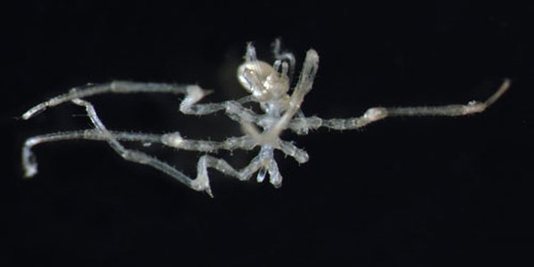
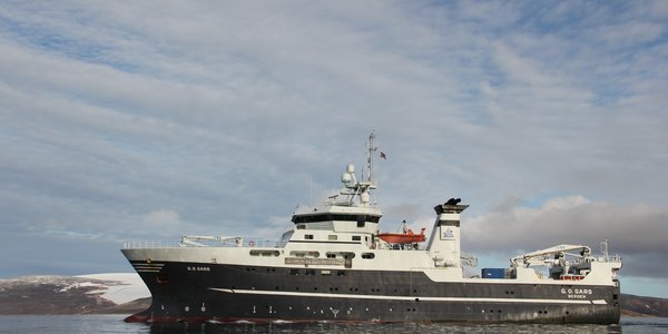
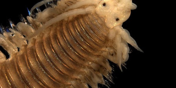
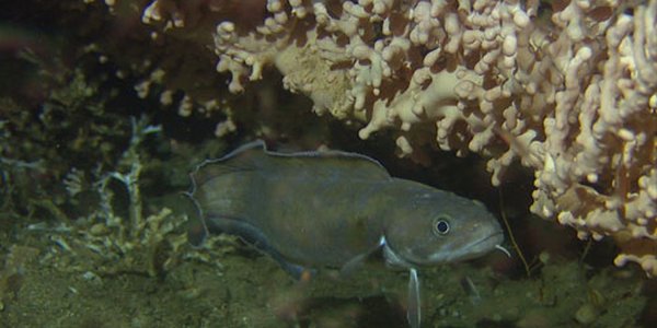
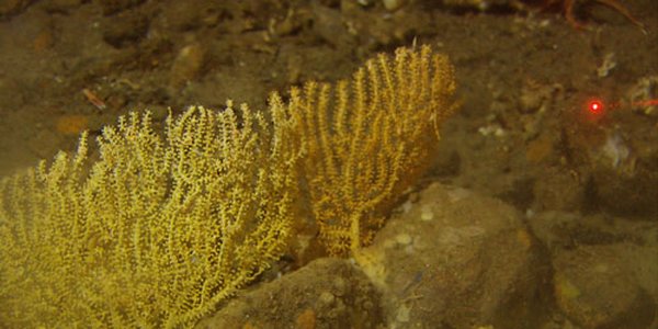
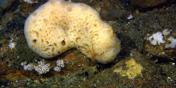
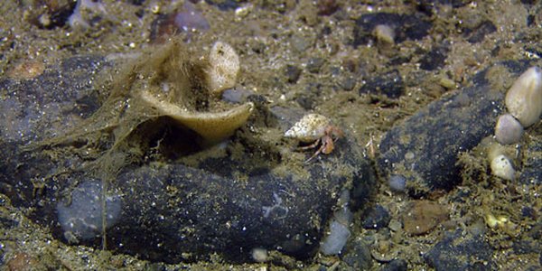
Goto main content

News

Result: (151) Showing 121 - 150

skyggerelieff 1

Results from ongoing bathymetric surveys

18.09.2012

The vessel MS Hydrograf is currently acquiring bathymetry data as part of the MAREANO project. This is a short presentation of some bathymetric features recorded across the Sularevet reef, which has been surveyed this summer.

fig3

Re-use of data improves efficiency

18.09.2012

MAREANO has obtained access to existing bathymetric data acquired by other operators. The data are very valuable and will contribute to the progress of the programme.

page thumb 9526

The map service "Shaded relief maps" is updated

18.09.2012

The map service which shows seabed terrain has been updated with data from the Norwegian Sea.

brosme og koraller 500

MAREANO Survey will Map Coral Reefs and Fishing Banks

18.09.2012

In mid-September, R/V G.O. Sars embarked upon the 2012 MAREANO (Marine AREA database for Norwegian coastal and sea areas) fall survey. This year’s study area includes: coral reefs at Sula Reef outside South Trøndelag; several fishing areas along the route Kristiansund - Halten; and selected areas of the Møre Bank and Storegga North.

page thumb 9522

International MAREANO-workshop

31.08.2012

International workshop on methods and technology for seabed mapping – Trondheim 17th-18th October 2012.

m Phyllodoce sp R367 46 500

MAREANO finds unknown species

26.06.2012

Dozens of new polychaete species unknown to science have been detected in seabed samples collected by MAREANO in the Norwegian Sea during the last couple of years. In addition, scientists have been able to extend the known area of occurrence of a number of species. The findings contribute to an increased understanding of species diversity in the little-known and "invisible" animal world within the deep-water bottom sediments off the North-Norwegian coast.

k skygge

Three vessels mapping bathymetry

12.12.2012

Three marine survey vessels are currently acquiring bathymetry data for the MAREANO project. Mapping has got off to a slow start because of strong winds and high seas, but we are hoping to make up some of the lost time.

1 R930VL959 Storegga gulkorall 350m

MAREANO's spring-cruise was finished in deep water at Storegga

12.12.2012

The first MAREANO cruise this year has been successfully finished after a one month survey off Vesterålen/Nordland VI and off North-Trøndelag and Møre. The last 2-3 days were used for video filming in the northern part of the Storegga where both depth and fauna communities varied. In deep water the communities were affected by sub-zero temperatures and a thousands of years old underwater slide.

Fig4b 220512

Spring cruise on the Mid-Norwegian shelf

12.12.2012

The second leg of MAREANO’s spring cruise has now been south to the Mid-Norwegian shelf. One area 3900 square kilometre large between Kristiansund and Halten, and a second 2900 square kilometre on the northern part Storegga have been mapped by video.

mareano svamp

MAREANO finds unknown cold-water coral reefs off mid-Norway

18.05.2012

Cruise report: The second part of MAREANO's "spring cruise" is underway and is due to end in Tromsø 22 May after a 10-day cruise off the coast of Trøndelag, mid-Norway. After two days of investigations three unknown coral reefs have been found, of which one is probably a couple of hundred meters long.

bilde 1 annenkovae

Museums, MAREANO, Maps and Taxonomy

11.05.2012

Cruise report: MAREANO continues to accumulate many samples and a multitude of marine organisms. Many of these will be held in the Bergen University Museum and made available for researchers all over the world. The description and classification of organisms is a prime function of museum staff and such taxonomic research has brought us from the National Museum of Wales to the Norwegian Sea.

No image

MAREANO's spring-cruise

07.05.2012

Cruise report: MAREANO's spring-cruise with R/V G.O. Sars has now been going on for about one week. The purpose of this first part of the cruise is to complete the mapping of habitats, benthic fauna and pollutants in the Nordland VI area off Lofoten, while in the second part video-filming will take place in the Storegga area and an area between Kristiansund and Halten.

bilde2

M.Sc. in environmental chemistry

02.04.2012

Ida Bendixen Leinebø recently finished a master’s programme in environmental chemistry at the Department of Chemistry, University of Bergen. During the past two years, she has done her experimental master work at the Chemistry Laboratory at the Institute of Marine Research: analyses of radionuclides in sediment cores collected as part of the MAREANO programme.

korall

MAREANO heads south

02.04.2012

So far, the MAREANO project has focused on areas off the counties of Nordland, Troms and Finnmark. This year, areas off Møre og Romsdal will also be surveyed. The aim is to produce biotope maps to assist with the revision of the management plan for the Norwegian Sea by September 2013.

kjemi 500

New measurements of hydrocarbons

16.01.2012

The maps with the levels of hydrocarbons are now updated with the results from the 23 locations investigated in 2010. Same as before, the levels are low at all the places where sampling was carried out.

svamp 500

MAREANO presented in Portugal

19.12.2011

Bio-prospecting and benthic mapping were highlighted during the conference “On the exploration and utilizing the resources of the sea” that was arranged in historical environments in Lisbon on Wednesday Dec 14. MAREANO was among the invited speakers.

Fig5 R746VL774 still a 00 07 02 utsnitt

Tracking the environmental state of the

21.09.2011

Modern environmental state and its recent changes can be assessed by studying successions of fine-grained sediments accumulating in shelf basins experiencing very weak or no current. Low current in such basins facilitates continuous deposition, a few millimeters per year, of mud and organic remains that are the main carriers of contamination in the marine environment.

Cilunculus battenae alternativ 2 500

New sea spider found in Norwegian waters

25.05.2011

The sea spider Cilunculus battenae was recently recorded in the Norwegian Economic Zone (NEZ) for the first time, when bottom samples from the MAREANO cruises from 2007-2009 were analysed. So far 21 different species have been found in the samples. Two species have previously been observed in the NEZ a few times.

fig1 eng 500

Strong Currents and Seabed Habitat Offshore of the Finnmark Coast

26.04.2011

The strong currents off the coast of Finnmark are renowned by local seafarers, and our latest observations North of Nordkynnhalvøya are shedding light on what affect these currents are having on the seabed.

GOS

"G.O. Sars" discovers geological secrets

30.09.2010

During a 500 km long transit from Troms III to Nordland VI the MAREANO project has acquired new data from the upper sediment units. We applied Topas, a kind of strong echosounder sending signals at regular intervals into the seafloor.

page thumb 9252

Investigating the shallow areas of Lopphavet in Troms

27.09.2010

MAREANO has completed the mapping at Troms III outside of Arnøya, located in Lopphavet in Troms, and is now steaming southwards to Nordland VI, at the southern tip of Lofoten.

m Fig 4 Pagurus stone w spiderweb

Mapping the seabed of the continental slope west of Sørøya, Northern part o

21.09.2010

In the afternoon, the 17. September, the scientific vessel G.O. Sars headed north from Tromsø. The ocean was calm, the wind was warm and the sunset colored the sky. The MAREANO autumn survey had started. We reached our destination north west of the island “Sørøya”, about 71° north, by midnight.

No image

Successful MAREANO summer cruise comes to an end

13.08.2010

This summer’s MAREANO cruise with research vessel “G.O. Sars” ends today in Tromsø, with no time lost due to bad weather or equipment problems we have been very lucky, and have completed all the planned work, and a few extras. The Troms III area offshore north Troms (north Norway) has been the focus of the second leg of the cruise, continuing the good work begun in the first leg. Following video surveys over several previously undocumented coral reefs during the first leg, right at the end of the second leg we were lucky enough to encounter yet another reef, around 20 km north of Vannøya.

No image

Mapping the sea floor north of Nordkapp

10.08.2010

During the summer cruise of 2010, MAREANO completed mapping of a 150 km long and 16 km wide transect on the Nordkappbanken. During three days, R/V "G.O. Sars" made video recordings of the seabed at a total of 18 stations, and the sea bed was sampled with different types of equipment at four stations. Water depth in the mapped area ranges from 230 m to 315 m.

m bilde 2b settes sammen 2a

News and pictures from the MAREANO summer cruise 2010

09.08.2010

A quick note from all on board the Norwegian research vessel ‘G.O. Sars’. We are making good progress with the first of two MAREANO cruises to be undertaken this year, and are now mid-way through the second and final leg of this research cruise.

Eggakanten FieldNT english stort

A general nature-type map for Eggakanten

08.03.2010

Mapping the distribution of seabed nature types is an important component of MAREANO. Nature types follow, and contribute to the development of the Norwegian Nature Types classification scheme at the nature-system level.

page thumb 9151

2700 metres below sea level

24.11.2009
Blue holothurians (sea cucumbers) amongst sea lilies together with brilliantly red shrimps and irregular sea urchins were just some of the astonishing creatures that scientists observed when they earlier this autumn they explored the sea bottom down to 2700 metres depths in Nordland VII, an area off the coast of Northern Norway.
medusahode 500

Investigating the Norwegian continental shelf and deep slopes in the arctic

07.10.2009

R/V G.O. Sars left Tromsø harbour 18 September with steady course heading for the “Eggakanten”, the continental shelf break northwest off the Norwegian mainland, approximately half-way to the Bear Island. The mission was to map the seabed as part of the Norwegian mapping programme MAREANO. The cruise is divided in two legs; the first, which we report from here, was undertaken between 18 and 30 September and the second leg which runs from 30 September until 11 October. Onboard were 14 scientists and technicians within the fields of marine taxonomy, geology and chemistry.

page thumb 9120

New articles from MAREANO

19.08.2009

In the beginning of August (2009) the Norwegian Journal of Geology published a thematic issue with 15 new articles mainly based on results from MAREANO.

page thumb 9040

The April 2009 MAREANO cruise

22.04.2009

Scientists from the Institute of Marine Research (IMR) and the Geological Survey of Norway (NGU) have started the April 2009 MAREANO cruise (2009105) aboard the "G.O. Sars". The scientific crew includes Norwegians, French, Danish, Canadian, German, Faroese and Finnish. The northernmost study area is located on the continental shelf, approximately 195 nm north of the Norway coast. The 9000 km2 large study area, covered by the cruise, includes depths ranging from 300 to 1000 meters, and will be mapped for benthic fauna, bottom types and environmental status.