Contact
Biological mapping
Børge Holte
+47 77 60 97 53
Geological mapping
Terje Thorsnes
+47 73 90 42 75
Bathymetry
Hanne Hodnesdal
+47 51 85 88 23
Information officer
Beate Hoddevik Sunnset
+47 55 23 85 16
Published: 12.12.2012 Updated: 03.10.2022
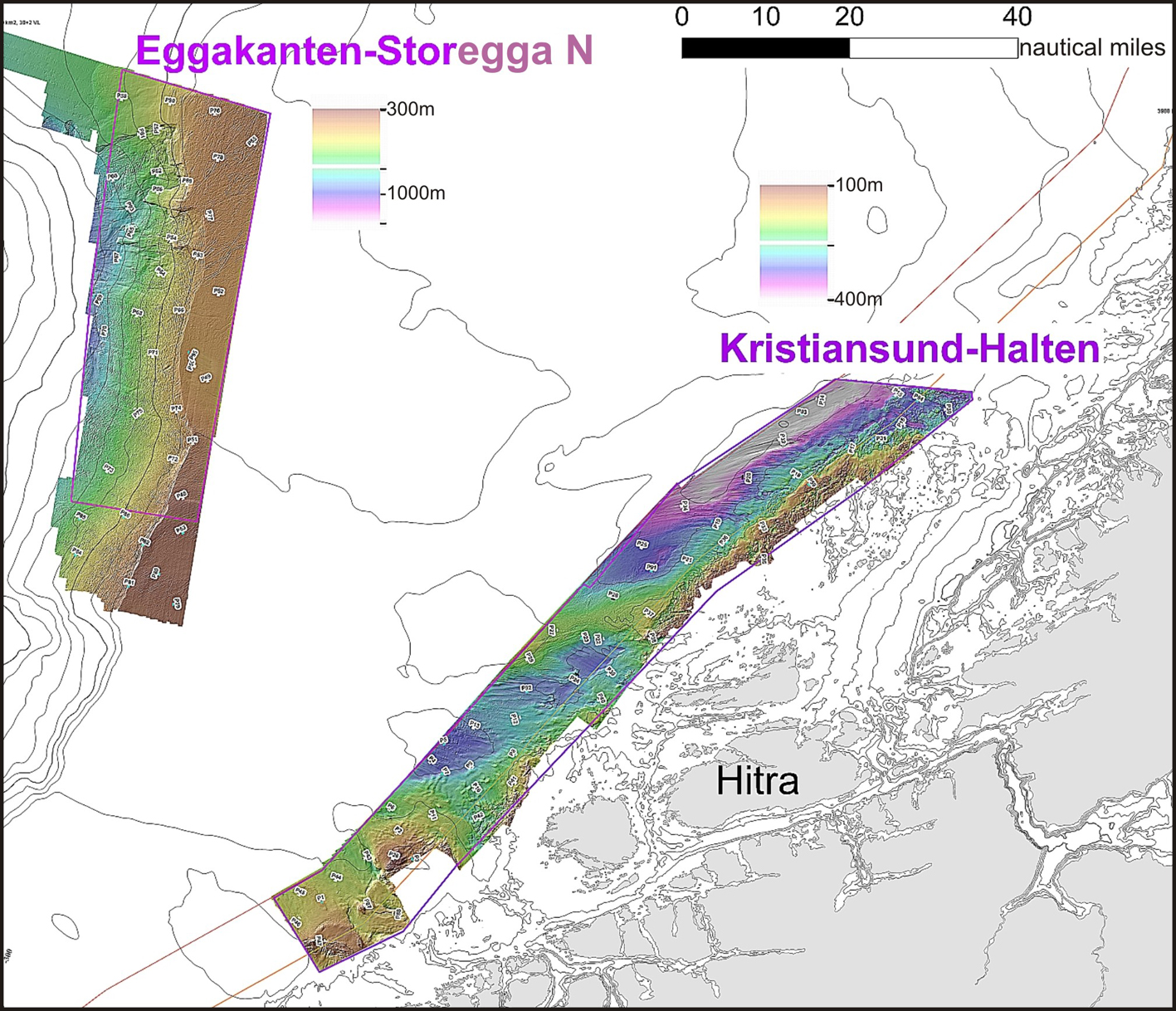
Investigation areas with video stations. Sampling for geology, biology, and contamination will be performed in 2013.
 About 70 video lines were planned to study the fauna and seabed conditions, based on information from detailed bathymetry and backscatter data. Each video line is 700 m long and recorded using a high resolution camera with a large zoom that gives detailed pictures of the surface sediments and the flora and fauna on the seabed. Sonar data are collected between the video stations, providing information about the sediment layers below the seabed.
Footprint of the Ice Age
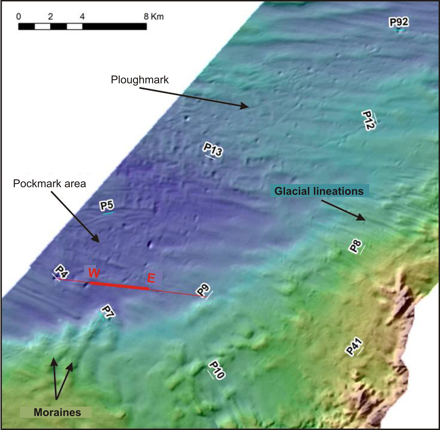
On the continental shelf off Møre and South Trøndelag the seabed shows evidence of the last continental ice sheet that covered the area. Here we find mega scale glacial lineations formed by glaciers sliding along the seabed, moraine ridges formed in front and at the flanks of glaciers, and ploughmarks from rafting icebergs. The glacial forms are more or less covered by fine-grained sediment (clay, silt and sand) deposited when the ice retreated about 15 000 years ago and to present.

Topas profile showing an up to 20 m thick layer of fine-grained sediment deposited during the last 15 000 years. A pockmark is seen on the western edge of the profile. The map in the upper right shows mega scale glacial lineations, moraine ridges, iceberg ploughmarks and pockmarks. Location of the Topas profile is marked by a red line. (The terrain model is produced by MAREANO based on bathymetry provided by the Norwegian Defence Research Establishment (FFI)).
Deposits and pockmarks
Sediments are distributed across the seabed mainly by bottom currents. On banks and ridges with strong currents there is little or no sediment deposition, whilst in basins and deeper areas with weaker currents there is continuous deposition of fine-grained sediment. In some of these basins we find small depressions, so-called pockmarks, where fluids have, or are, seeping from the seabed.
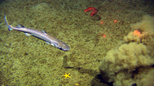
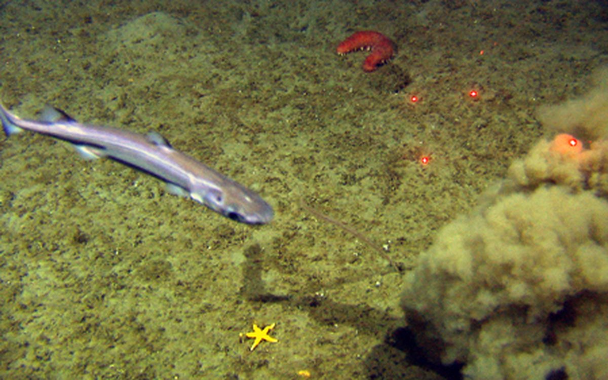
The picture shows a shark passing by a star fish (Henrisia sp.) and a red sea cucumber (Parastichopus tremulus), both of which like to live in areas with sandy sediments. Disturbance from the video rig is in the bottom right corner of the picture.
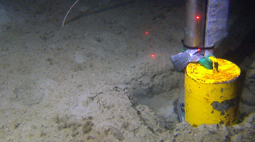
The picture shows fine-grained sediment (clay and silt) within a pockmark. A leg of the video rig is seen to the right. Distance between the laser dots is 10 cm.
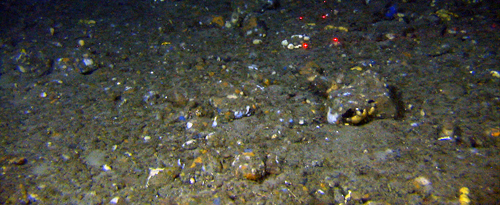
The picture shows a coarse-grained bottom type dominated by sand, gravel and cobbles. The blue spots represent encrusting sponges (Hymedesmia paupertas) whilst the white are different types of small sponges.
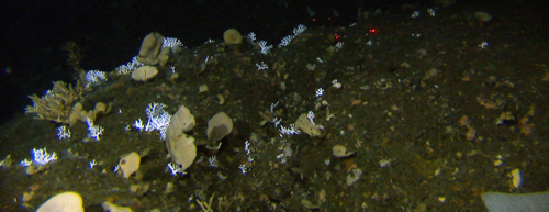
Here we see bedrock covered with Phakellia forest and Hydroide Stylaster spp. (the white bushes).
Discovery of new coral reefs
The video lines in the area between Kristiansund and Halten show varying bottom conditions. Along the moraine ridges where the bottom current is strong and the bottom sediments consist of coarse-grained sediments, corals have settled and formed reefs. Several new coral reefs have been found during this MAREANO cruise.