Contact
Biological mapping
Børge Holte
+47 77 60 97 53
Geological mapping
Terje Thorsnes
+47 73 90 42 75
Bathymetry
Hanne Hodnesdal
+47 51 85 88 23
Information officer
Beate Hoddevik Sunnset
+47 55 23 85 16
Published: 21.09.2011 Updated: 07.12.2022
By slicing up and studying sediment cores from muddy basins, one can obtain an environmental record. The top sediment slice in such record characterizes the modern environment whereas the deeper intervals provide information about the past conditions.
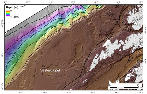
Due to the strong current regime in the area west of Lofoten (Nordland VI) that is the target of the MAREANO 2011 fall cruise, most of the seabed of the continental shelf consists of sandy and gravelly sediments. These coarse-grained sediments have limited value for contamination studies as fine-grained contaminants that may be present in the environment are effectively washed away, and do not get recorded in the sediments. Muddy sediments on the other hand have limited lateral extent on the Nordland VI continental shelf, and are found only in a few depressions protected from the strong currents. One of the depressions, Vesterdjupet (Fig. 1), has been surveyed in a greater detail during the first week of the cruise.
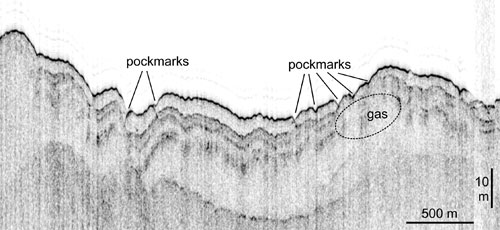
Multibeam echosounder bathymetric and backscatter data that were interpreted before the cruise indicated that the Vesterdjupet serves as a regional depocenter for the fine-grained, soft sediments. Presence of numerous pockmarks, small depressions that are formed by the upward gas/fluid flux and expulsion, was also evident in the multibeam data from Vesterdjupet (Fig. 2).

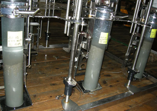
Results of seismic profiling, video observations and sediment sampling obtained during the cruise confirmed the quiet sedimentation regime in Vesterdjupet and showed that the succession of fine-grained sediments from Vesterdjupet may well serve as the regional environmental archive. Successful deployment of the multicorer yielded six excellent c. 30 cm long cores with undisturbed sediment surface (Fig. 3). The upcoming analysis of heavy metals and organic contaminants, integrated with the results of sediment dating will help to decipher the current environmental state of the seabed, the recent trends as well as the sources of contaminants.
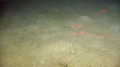
The presence of pockmarks in Vesterdjupet is a morphological sign of gas and/or fluid seepages from the underground. A seismic profile obtained from the pockmark area provided additional indications for the seepage. Prominent sub-surface reflectors are disrupted in places, occasionally below pockmarks, consistent with the presence of gas in the sediments (Fig. 4). Video records from Vesterdjupet (Fig. 5) were carefully screened for physical evidence for gas seeping and for methane derived carbonate crusts, but no obvious evidence for these seepage indicators were found.