Contact
Biological mapping
Børge Holte
+47 77 60 97 53
Geological mapping
Terje Thorsnes
+47 73 90 42 75
Bathymetry
Hanne Hodnesdal
+47 51 85 88 23
Information officer
Beate Hoddevik Sunnset
+47 55 23 85 16
Published: 12.12.2012 Updated: 24.10.2019
Three marine survey vessels are currently acquiring bathymetry data for the MAREANO project. Mapping has got off to a slow start because of strong winds and high seas, but we are hoping to make up some of the lost time.
By Hanne Hodnesdal, Norwegian Mapping Authority, Hydrographic Service
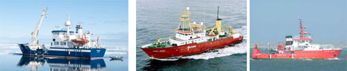
The marine survey vessels RV Hydrograf, MV Fugro Gauss and MV Victor Hensen.
The three marine survey vessels now acquiring data for the MAREANO project are the RV Hydrograf, the MV Fugro Gauss and the MV Victor Hensen. One vessel is working in selected areas in the Norwegian Sea, while the others are mapping in the Barents Sea, in the former disputed area along the territorial boundary with the Russian Federation.
The Mapping Authoritys own vessel RV Hydrograf started work at the beginning of April. It will carry out mapping assignments for the MAREANO project across Iverryggen, Sularevet, parts of Mørebanken and the continental escarpment, for four months during 2012. These areas have been assigned priority in connection with the revision of the governments Integrated Management Plan for the Norwegian Sea. Unfavourable windy conditions and high seas during the early part of the mapping programme have caused the vessel several interruptions. Bathymetric data acquired in high seas will contain a lot of noise, especially when the vessel is sailing into the waves. This is why survey operations have to be interrupted in high seas. Currently, fieldwork is running a long way behind schedule. We are hoping for favourable conditions for the remainder of the operation so that we can make up for lost time. The Iverryggen stage has been completed, and the figure below illustrates the exciting seabed topography we find in this area.
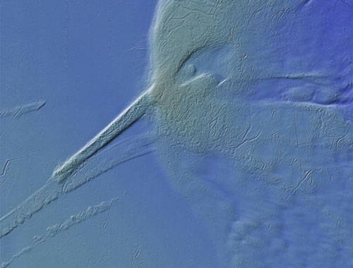
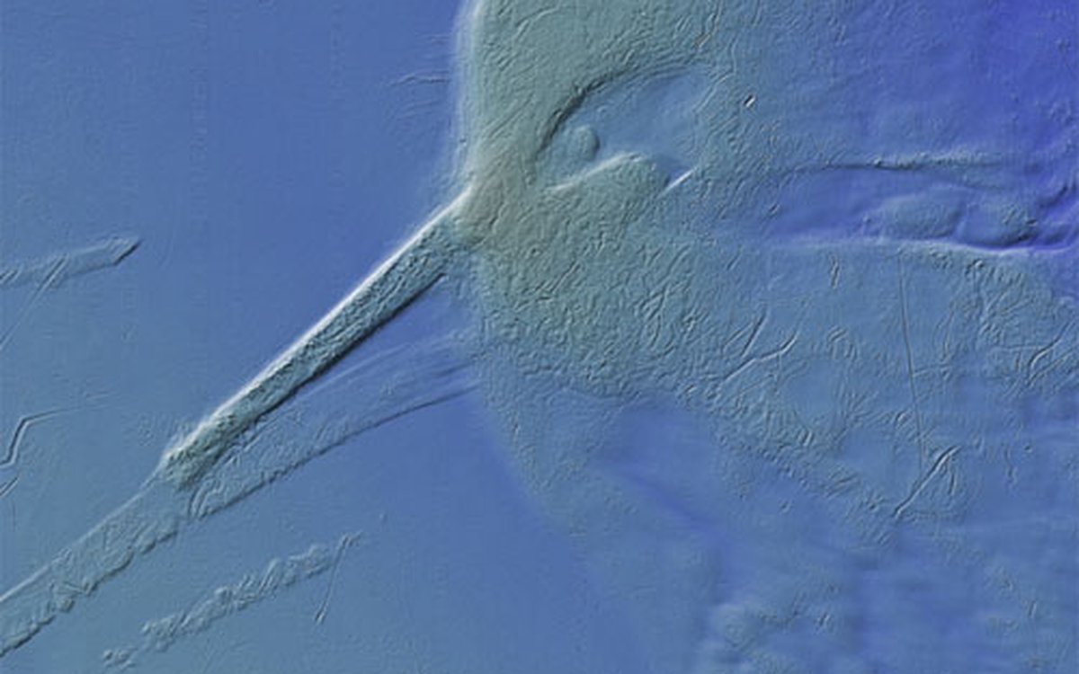
Shadow relief display showing parts of the seabed topography across Iverryggen. What does it look like?
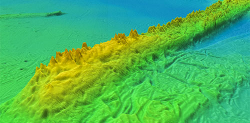
Shadow relief display showing details of seabed topography across Iverryggen. This terrain model has a resolution of 5 x 5 metres. The cone-shaped peaks are typical of coral reef features.
The two vessels MV Fugro Gauss and MV Victor Hensen, owned by the German company Fugro OSAE GmbH, commenced survey operations in the former disputed area on the 8 and 19 April, respectively. Both vessels encountered early technical problems, but are now well underway with their surveying work. In total, these vessels plan to map an area of 27,200 km2 in the Barents Sea, and 5,900 km2 across Skjoldaryggen along the continental escarpment in the Norwegian Sea. The contract worth NOK 36 million was signed in October 2011.
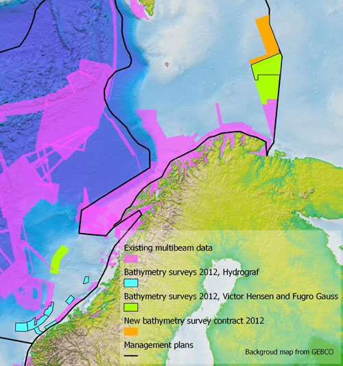
Bathymetric surveying carried out by the vessels RV Hydrograf, MV Fugro Gauss and MV Victor Hensen.
The Mapping Authoritys Marine Division will use the bathymetry data acquired in the Norwegian and Barents Seas to construct 3D models of the sea floor. It will also generate detailed shadow relief images, made up of colour 3D terrain models enhanced with shadow relief. The terrain models of the data sets acquired in the Norwegian Sea will be used during autumn cruises carried out by the Institute of Marine Research and the Geological Survey of Norway. The data from the Barents Sea will be used for similar projects in 2013. Terrain models are used to identify interesting structures such as coral reefs, pockmarks (gas emission sites), sand waves, and the modelling of biotopes.
Backscatter data and water column data are also acquired as part of these bathymetric surveys. Backscatter data provides information about how effectively the seabed reflects acoustic signals transmitted by an echo sounder, which in turn can tell us something about how hard or soft the seabed is. Water column data reveal reflections generated throughout the water column, and can be used to identify objects such as fish or gas bubbles. The Norwegian Geological Survey utilises both reflection data and water column data in its analytical work. The MV Victor Hensen is equipped with a gravimeter, which is used for making gravity measurements for Norwegian Mapping Authority, Geodetic Institute. Very little gravity data have previously been available from the disputed zone, and it is thus essential to acquire data from this area.
Decisions regarding the areas to be surveyed are taken by the MAREANO projects steering committee, made up of representatives from the Norwegian Ministries of the Environment, Fisheries and Coastal Affairs, Trade and Industry, and Petroleum and Energy, as part of its annual operations programme.