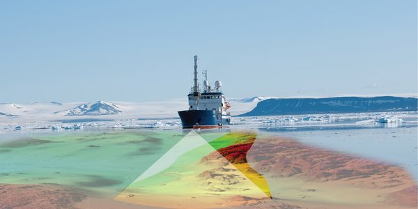
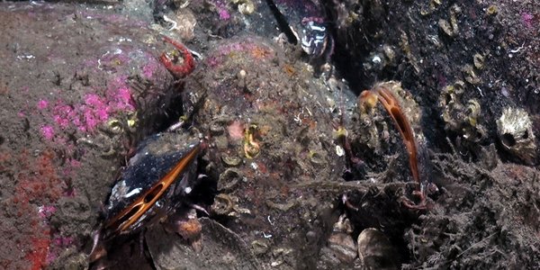
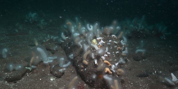
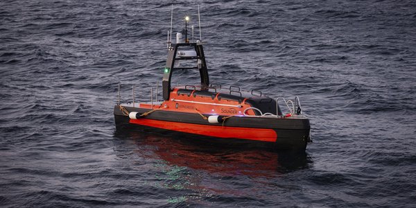
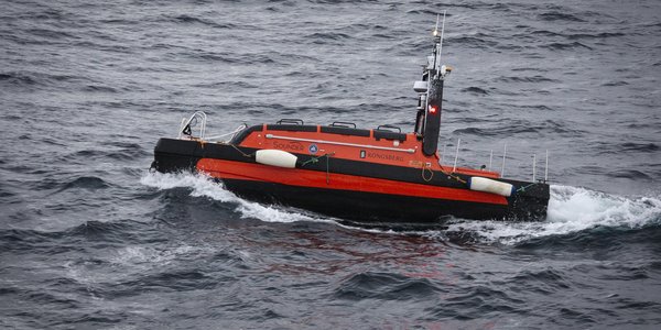
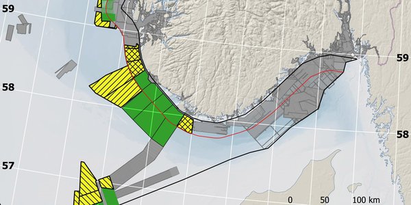
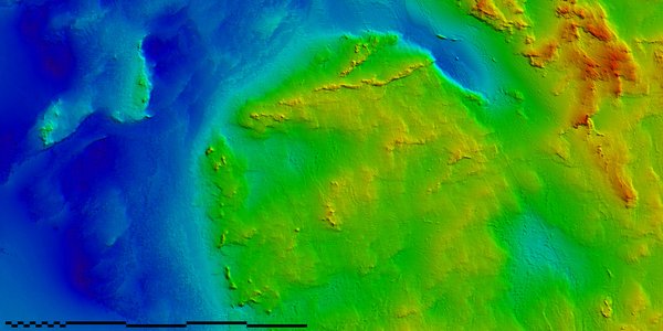
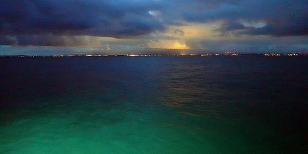
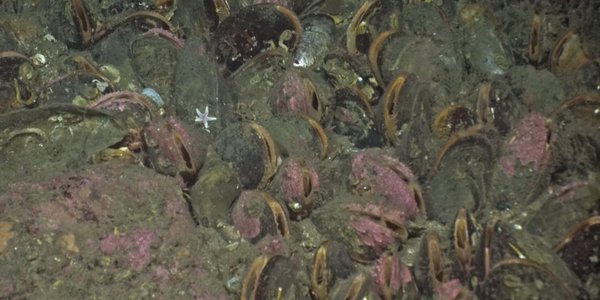
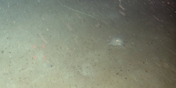
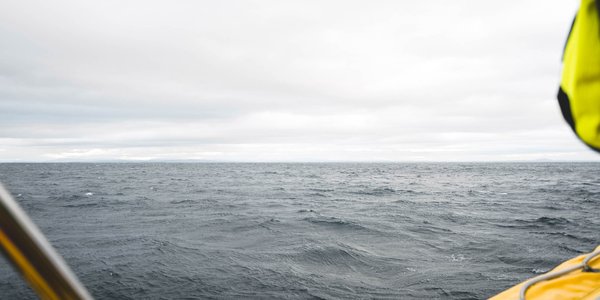
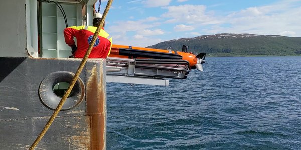
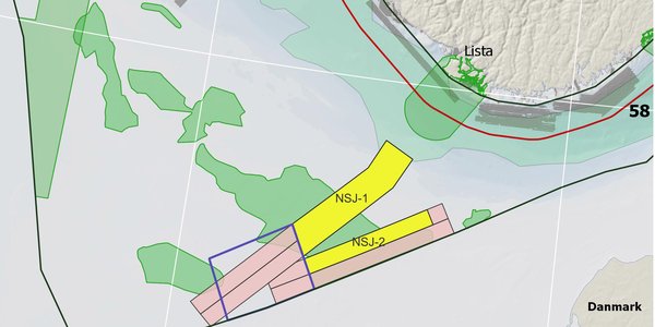
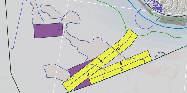
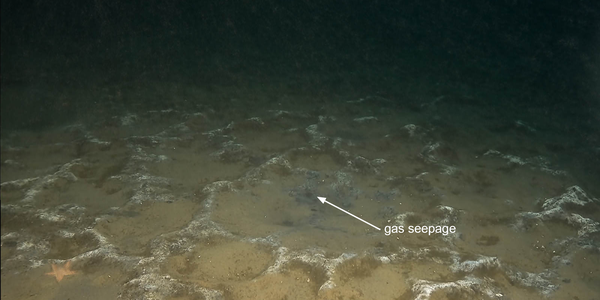
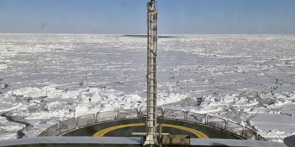
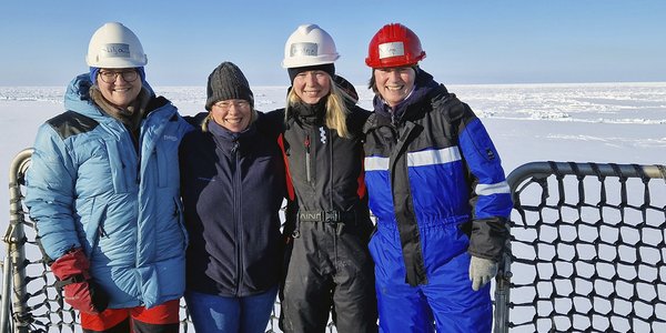
Goto main content

News

Result: (143) Showing 1 - 30

Tokt i Nordsjøen

Bathymetric mapping in 2023

14.03.2023

The MAREANO programme will conduct bathymetric mapping in Norskerenna in the North Sea this year. The assigned contractor is Fugro Germany Marine GmbH.

boat

New Tender for Bathymetric Mapping in 2023

28.12.2022

The MAREANO programme plans to conduct bathymetric mapping in Norskerenna in the North Sea. An invitation to tender for bathymetric mapping in 2023 is published. 

Sponge that has ended up at the bottom of a trawl mark

High concentration of trawl marks north of Svalbard

24.11.2022

Before surveying the area, scientists expected to find large areas of untouched seabed – and the odd trawl mark left by fishing boats. What they actually found was nothing like that.

Brasil Paneldebatt mareano

MAREANO presented in Brazil

08.11.2022

The activities of the MAREANO mapping programme were recently presented at a conference in the Brazilian city of Salvador. As part of developing a new, modern programme for marine spatial management, experts in Brazil want to learn from international actors.

Photo of a Norway lobster on the sea floor.

Crawling with Norway lobsters

27.10.2022

Expedition diary: After a few days of extensive exploration of the muddy, sandy plains at our sampling area outside of Utsira, we arrived at a station with exposed rock.

Seapen.

Deep in seapen country

20.10.2022

Expedition diary: We have been out here for a few days now and it is clear: we are deep in seapen country!

figure1 top lyst

Above and below

05.07.2022

Expedition diary: As we arrive in the north with RV Kronprins Haakon, we are greeted by a brand new white world of icebergs and sea ice. At a first glance this polar desert appears void of life, however, when we take a closer look we find the opposite to be true. We are surrounded by living creatures – both above and below the sea.

launching AUV

Mobilising Munin+ for MAREANO

03.06.2022

Expedition diary: And now for something completely different. Standard MAREANO sampling cruises collect biology, geology and chemistry data using video and physical sampling. This cruise is dedicated to exploring new methods, specifically, what MAREANO could gain from the use of autonomous underwater vehicles (AUVs).

Map with marked areas in the North Sea where MAREANO plans to conduct bathymetric mapping in 2022.

Bathymetric Mapping in the North Sea in 2022

19.05.2022

In May, the Clinton Marine Survey AB began the bathymetric mapping in parts of the North Sea for the MAREANO programme. Until the beginning of August they will survey 2730 km2.

map model with markings

New Tender for Bathymetric Mapping in 2022

21.01.2022

The MAREANO programme plans to conduct bathymetric mapping in the North Sea this year. An invitation to tender for bathymetric mapping is published. 

Solnedgang

Mareano expedition completed

06.10.2021

Expedition diary: It is 18:25 on Sunday evening, and where we are, the sea is almost 500 metres deep. Our video rig hovers lazily over the sea floor. It is completing the final metres of a total of 33.4 kilometres of video transects on the Spitsbergen Bank, before G.O. Sars can set sail for Tromsø.

Spits ENG 1 nett

Strong currents shaping the seafloor of Spitsbergenbanken

05.10.2021

Cruise diary: When we arrived at Spitsbergenbanken a few days ago, we were met by strong currents. On the seafloor, the currents shape sediments into different types of bedforms, with the most common being ripples, which are centimetres to decimetres high, but also larger bedforms such as sandwaves, or sandbanks which can be more than 10 m high.

P9260279

In the borderlands of the Polar Front

04.10.2021

Expedition diary: After two weeks at sea, we have seen how benthic communities change with the seabed substrate and bottom-water temperature, from east to west on the Spitsbergen Bank. From the relatively deep mudflats in the south-east, to the rocky slopes in the north and further west towards Bear Island, we have observed large quantities of dead bivalve shells and shell fragments, as well as some high-Arctic benthic fauna. We are in the borderlands of the polar front.

Valerie sept 2021 ingress

Spitsbergenbanken from the deep south to the shallow north

28.09.2021

Cruise diary: On the last Mareano cruise of the year to Spitsebergenbanken, we had strong winds and 4-5 m high waves south of Hopen. With the video rig parked on the seafloor at 150 m depth, we could observe how suspended sediments and animals living on the seafloor drifted back and forth in the same wave motion as the research vessel G.O. Sars. This shows that waves, in which we commonly think only occur on the sea surface, may also affect the seafloor at large depths.

R2750VL2819 Cephalopoda

Meet the churchyard residents!

27.09.2021

Expedition diary: The Mareano expedition has reached Kirkegården (“the churchyard”), south-east of Svalbard and Spitsbergen Bank. We lower a large camera rig to the sea floor to have a look. Mud and sand are whirled up when we land, and initially we cannot see a thing. At first sight the sea bottom at Kirkegården appears to be a desert, but in spite of its sinister name, this churchyard is full of life! Here you will meet some of its many residents. 

Engsept2021 Toppfigur esker nett

Ice age remnants on Spitsbergenbanken

23.09.2021

Cruise diary: MAREANO continues its mapping of Spitsbergenbanken and takes a closer look on some of the landforms made when the bank was covered by a thick glacier.

Cruise participants

Spitsbergen Bank is next in line

20.09.2021

Expedition diary: After sailing for 33 hours from Tromsø, we are approaching Spitsbergen Bank, which is well-known as a highly productive sea area between Bear Island and Hopen. We will also be surveying an area called Kirkegården (“the churchyard”), although no-one on board is sure how it got that name. 

fgmg 2020 TR TF2 NS05 celle001 B

MAREANO Annual Report 2020

05.07.2021

This report gives an overview of conducted mapping surveys and programme results/deliverables of the MAREANO programme in 2020. A summary in English is included, the rest of the report is in Norwegian.

fisk ankervinsj

Scientists discover a missing shipwreck from 1913

28.05.2021

Researchers on a MAREANO-cruise found a wreck off Bodø that they assume must be DS Malmberget. After 108 years, we may be close to solving the mystery of this ship, which disappeared in a storm with 43 people on board.

The vessel MPV Pohjanmeri in an Arctic environment. Photo: Arctia Meritaito Ltd.

Bathymetric Mapping in 2021

26.05.2021

Arctia Meritaito Oy is going to carry out bathymetric mapping in three smaller transects in the Barents Sea this year. The vessel MPV “Pohjanmeri” starts the expedition June 15th.

VB erosion hoved

Current events at Aktivneset

27.04.2021

Cruise diary: After 16 hours transit from Garsholbanken, we arrived at a new sampling area, west of Aktivneset. This place is special as it is located at the outer part of the Norwegian Channel, a channel that starts south of Oslo and curves around Norway, before reaching Aktivneset.

fgmg 2020 TR TF2 NS05 celle001 B

New Tender for Bathymetric Mapping in 2021

07.01.2021

The MAREANO programme will continue the bathymetric mapping in the Barents Sea this year, although only three smaller transects. A new tender competition for bathymetric mapping was published 8 March 2021.

Primnoa Lophelia sei Sklinnab justert  R2293

The MAREANO survey continues to the Sklinna Bank off mid-Norway

31.07.2020

Cruise diary: The ongoing MAREANO survey has now moved southwards from the Træna Bank to the Sklinna Bank on the mid-Norwegian shelf. The seafloor terrain here varies more than farther north, and we have found hitherto unregistered cold-water coral reefs.

Valerie fig4 nett

Horseshoe and cold-water coral reefs

29.07.2020

Cruise diary: In the framework of this year´s seabed mapping on the Norwegian continental shelf, R/V "G.O. Sars" arrived on Trænabanken last week.

Fig 1 IMG 9024

Seabed mapping in the Norwegian Arctic

05.11.2019

Thursday afternoon, on the 10th of October, RV G.O. Sars left Tromsø harbour, heading for Kvitøyrenna, a bathymetric trough located between the islands Storøya and Kvitøya within the eastern part of the Svalbard archipelago. It is a long way from Tromsø to Kvitøya, and the transit was planned to take two and a half day. However, the trip took even longer when a northerly wind picked up.

valerie fig3c

Shallow, but beautiful

30.10.2019

MAREANO is currently on cruise gathering visual and physical seabed samples from several areas around the Svalbard archipelago in the Norwegian Arctic. At the moment we are back in outer Kongsfjordrenna trough, offshore of northwest Svalbard, after a couple of days working closer to shore in Kongsfjorden due to poor weather. Here we tell you a little bit about what we have seen here.

e Umbellula

New general biotope map for the Barents Sea

24.10.2019

Mareano has now published an updated general biotope map for the Barents Sea. This map more than doubles the area for which biotopes distribution has been predicted in this area, and provides the first indication from Mareano results of distinctive habitats occurring in Arctic waters and north of the Polar Front.

bilde2

MAREANO side event at Our Ocean 2019 Thursday 24 October 7.30-8.30 AM

22.10.2019

The Our Ocean 2019 conference is being held in Oslo 23-24 October 2019. The conference brings together leaders from governments, businesses, civil society and research institutions to share their experience, identify solutions and commit to action for a clean, healthy and productive ocean. Several side events are open to the public, including our event named “MAREANO – A Unique seabed mapping programme”.