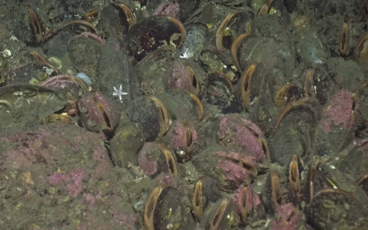
The orange "lips" of the mussels are clear close up, and it becomes easier to notice all the animals living in, around and on top of the mussels (e.g. encrusting red algae, sea stars (Lepasterias sp.), bryozoans and keel worms.
Photo: Mareano / Havforskningsinstituttet
The oasis of a lost land
Expedition diary: On this easter MAREANO survey, a lot of our time has been spent on sandy plains occasionally encountering sea stars and flat fish. But sometimes we come across a different landscape that makes us all sit up and say “wow”!
Published: 03.05.2023Author: Rebecca Ross and Terje Thorsnes
This video line was one of those.
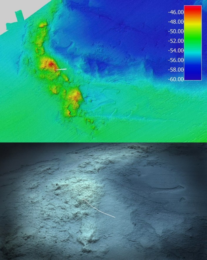
We knew that this site might give us a change: the multibeam echosounder maps showed a crescent-shaped ridge, 3 km long and 10 m high, made of hard substrate. This is likely a moraine ridge – piles of cobbles and boulders shoved together with sand and gravel by glaciers working like bulldozers so that when that bulldozer retreats it leaves a ridge of stone.
An overview of the crescent shaped morainic ridge in the multibeam echosounder map (top) and a 3D perspective of the same (bottom), both showing the 225 m long video line ascending it. (Photo: MAREANO)
People now sit excitedly waiting for the expected change to hard substrates and their associated communities.
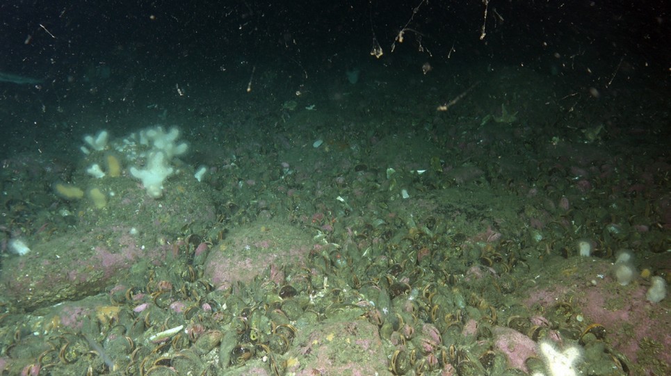
As we land on the bottom, we see the expected rocky landscape and start to notice a couple of things.
First, that the larger rocks are rounded. That is because this entire ridge was in the beach zone of a lost land around 12-13000 years ago. Then wind and waves rounded these rocks, just like they do to the rocks you see on shorelines today. At that time, the sea level was much lower because a lot of water was tied up in the ice sheets that covered large parts of the continents, including Norway. The lost land we see at this site was given the name “Agderia” in 2016.
The second thing we notice takes a moment to realise: that not all of the seafloor is made of rounded rocks, in fact around 60% of these rocks are alive!
At first it looks like lots of stones between bigger cobbles but then it becomes clear that these are mussels (Modiolus modiolus)! Photo: MAREANO / IMR
This is a horse mussel (Modiolus modiolus) bed.
They sit densely packed between the rounded cobbles and boulders, their shells opened a crack to show their orange flesh, and the siphons which they use to filter out their planktonic food.
These guys can reach 20cm in size and 45 years old!
As young horse mussels they are vulnerable to sea star, sea snail and crab predators, but by the age of 4 years old their shells are hard enough to resist attacks from predators. The adults bind together with fleshy threads, just like other mussel species, with the young attracted to settling on those threads where they may be able to shelter amongst the adults.
When forming dense populations, horse mussels also change the environment: they provide shelter for smaller animals who hide between their shells, they provide hard surfaces (on their shells) for some marine life to attach to, they stabilise soft sediments by creating this carpet, and they filter and clean the water around them. All of these changes lead to an increased biodiversity that wouldn’t happen without their presence.
As a result, the horse mussel is considered an ecosystem engineer and a keystone species. This means that, if trawled, dredged or otherwise impacted, a whole community and the associated environment could be altered. As a consequence, “Modiolus modiolus beds” with over 30% coverage are also an “OSPAR threatened and/or declining habitat” conservation target.
It quickly became apparent that this site qualifies as one of those OSPAR “Modiolus modiolus beds”, so we will be reporting its presence to OSPAR for monitoring.
We also hoped that we could have come home with an AUV map of this site, but the weather conditions were not cooperative before we had to leave this area. So, we are taking note of its location and will cross our fingers for returning in the next couple of years to try and get a more complete map of its extent and environment.