Goto main content

Bathymetric mapping in 2023

This year the MAREANO programme will conduct bathymetric mapping in the Norwegian Trench in the North Sea. The assigned contractor is Fugro Germany Marine GmbH. In addition, areas in the Barents Sea will be surveyed by the Norwegian Defence Research Establishment (FFI).

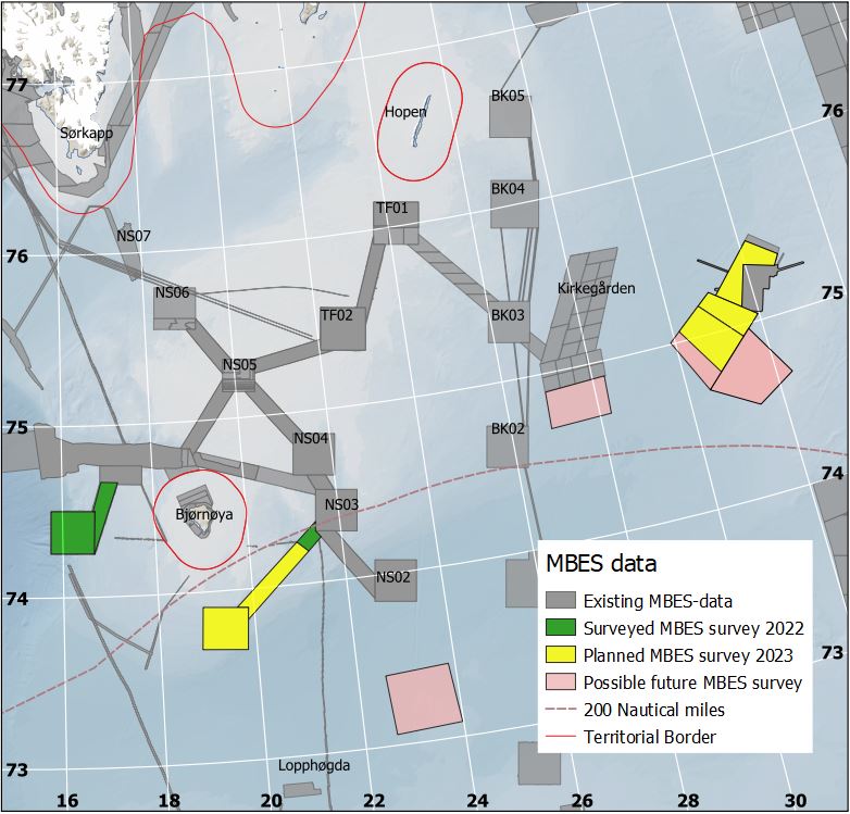
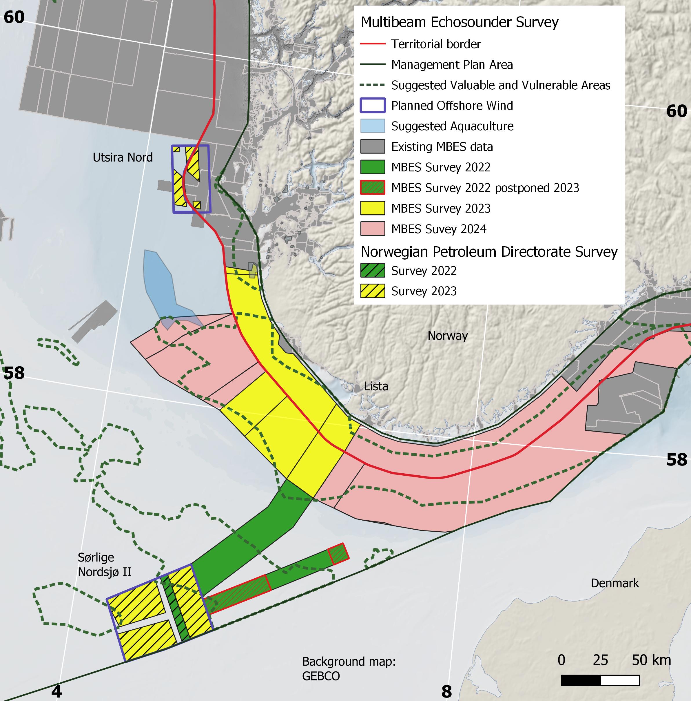
In 2023, the MAREANO programme will place emphasis on the North Sea. There is a need for marine knowledge linked to the new marine industries – such as offshore wind and offshore aquaculture – and the particularly valuable and vulnerable areas (SVO) proposed in the North Sea.

The contract comprises an area of 2887 km2. The bathymetric mapping will be conducted by Fugro Germany Marine GmbH in June–July 2023.

The open invitation to tender for the procurement of bathymetry data acquisition and processing and light seismic for the MAREANO programme, was published December 2022. The contract has a value of 17,5 million NOK.

I addition, MS «Hydrograf» will survey an area of 2693 km2 inside the territorial boarder in the Norwegian Trench. MS «Hydrograf» is owned by the Norwegian Mapping Authority, Hydrographic Service.

Map with coloured boxes marking areas in the Norwegian Trench in the North Sea where the MAREANO programme plans to conduct bathymetric mapping.
THE NORTH SEA: The yellow boxes in the map mark areas in the North Sea where MAREANO will conduct bathymetric mapping in 2023. Source: The Norwegian Mapping Authority/MAREANO

The Barents Sea

An area of 3169 km2 on the Spitsbergen Bank and Hopendjupet in the Barents Sea, will be surveyed by the Norwegian Defence Research Establishment (FFI). The bathymetric mapping will be conducted by the FFI's research vessel MS «H.U. Sverdrup II» in August–September 2023.

Map with coloured boxes marking areas in the Barents Sea where the MAREANO programme plans to conduct/has conducted bathymetric mapping.
THE BARENTS SEA: The yellow boxes marks transects and areas on the Spitsbergen Bank and Hopendjupet where FFI will conduct bathymetric mapping in 2023. Source: The Norwegian Mapping Authority/MAREANO


Contact

Photo of Nicolien Haasbroek

Nicolien Haasbroek

Norwegian Mapping Authority, Hydrographic Service
Bathymetry, procurements
Project Engineer
+47 51 85 87 13 / +47 418 56 917
Photo of Sissel Kanstad

Sissel Kanstad

Norwegian Mapping Authority, Hydrographic Service
Communications advisor
+47 51 85 88 28 / +47 995 13 848

Read more

boat

New Tender for Bathymetric Mapping in 2023

The MAREANO programme plans to conduct bathymetric mapping in Norskerenna in the North Sea. An invitation to tender for bathymetric mapping in 2023 is published. 

boat

Bathymetric Mapping

The Norwegian Mapping Authority Hydrographic Service is responsible for acquiring bathymetric data in areas which are to be mapped by the MAREANO programme.