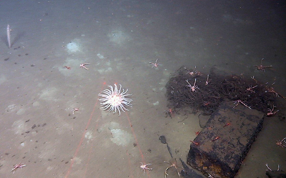
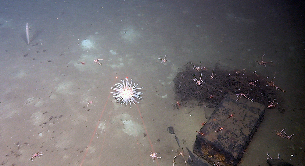
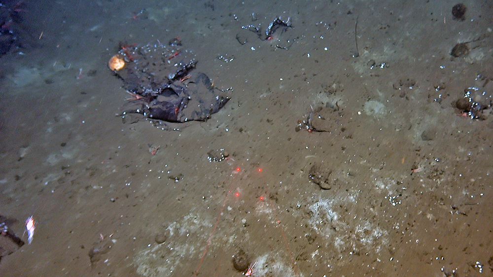
We have been watching a lot of videos with mud. But some surprises appear sometimes, like these boxes.
We have been watching a lot of videos with mud. But some surprises appear sometimes, like these boxes.
Published: 11.07.2023
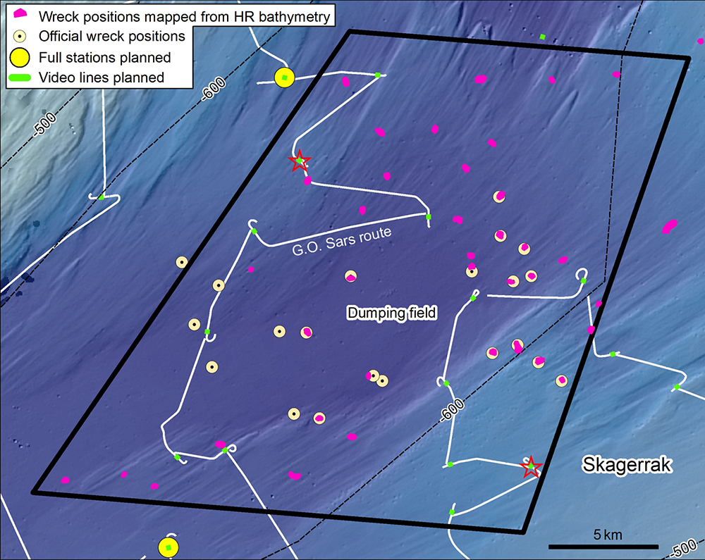
In Skagerrak there is such a dumping field, where ships loaded with chemical warfare munitions like mustard gas were deliberately sunken to the seabed 600 m below. It has been estimated that between 41,000 and 48,000 tons of munitions have been deposited in this area alone.
The sunken ships can be clearly seen in high-resolution bathymetry data, however sadly we are not focusing on the shipwrecks during this cruise, but rather the area around them. So, what did we encounter here?

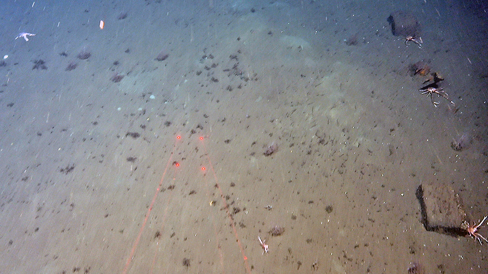
The answer is… mud… A LOT of mud. The seabed is covered by several metres of soft mud, and we have been watching hours of videos of muddy seabed. With occasional surprises like suspicious metallic boxes scattered in the dumping field.
54 wrecks have been already found in the Skagerrak, and 36 of these are believed to be part of the chemical munitions’ dumpsite (FFI-RAPPORT 19/00245). When interpreting the MAREANO high-resolution bathymetry (5 m pixel size), we can also see a high number of wrecks here, and most of them appear not having an “official” location yet.
Even if we are not crossing wrecks in this area even, we can see other human impacts with quite a lot of plastic litters of different sizes.
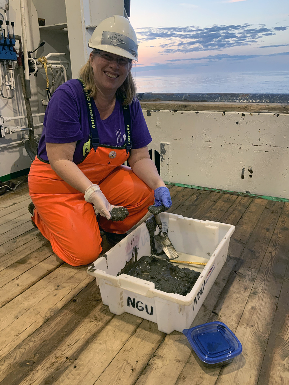
For safety reasons, no geological, biological, or chemical samples will be taken within the dumping field. Samples are taken around the dumping field, including chemical samples whose results will be very interesting to study in the coming year.
Due to the presence of mustard gas, explosives, and other chemical substances inside and possibly outside the dumping field, and the fact that we do not know exactly where all these dangerous products are, we need to wear gloves when getting in contact with the sediments. This makes things slightly more complicated for us geologists, when we try to feel through the gloves what type of sediment we are dealing with.
However, most of the collected samples proved to be fine-grained mud, with only a few samples having a small proportion of sand added to the mix.