Goto main content

News 2015

mareano bok

New book from MAREANO

In the occasion of MAREANOs 10th anniversary, a new book presenting the results of the mapping and surveys of the Norwegian sea floor has been released. The book, which is in English, is an expanded and updated version of the Norwegian book from 2010.

Gruppe bilde

Mission Accomplished — yet another successful cruise!

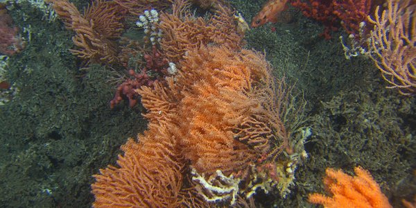
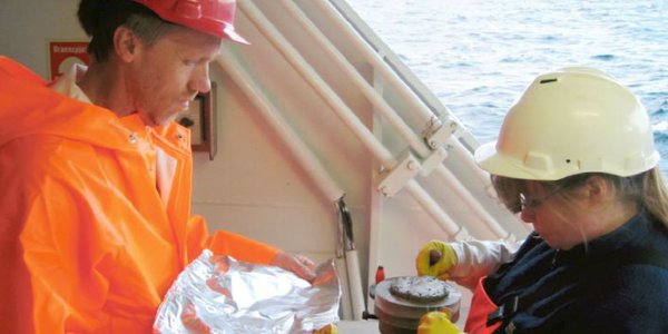
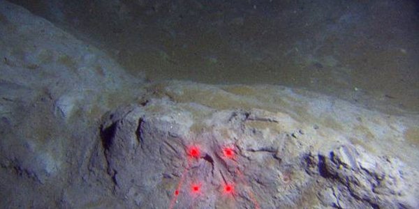
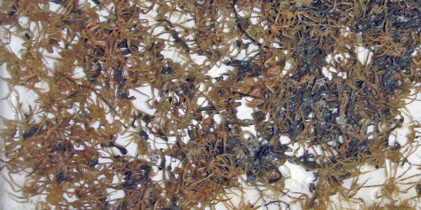
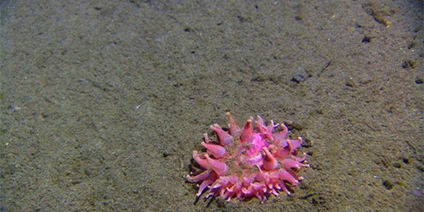
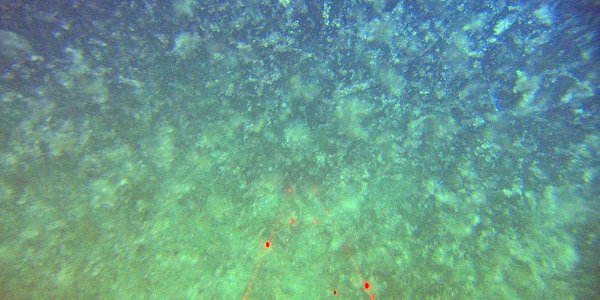
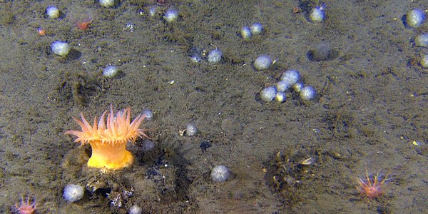
Cruise diary: During the course of two weeks the biology and geology was mapped at 73 locations along the shelf edge west of the town Sandnessjøen at depths ranging between 220 and 760 meters. At 14 of these sites, a total of 83 bottom samples were collected using grabs, cores, sleighs, and beam trawls. At all sites the seafloor was investigated and documented using the Chimaera video rig (Chimaera is the Latin name for the rabbit fish/rat fish).

R1564VL1613 00 41 24

New coral reefs discovered off Northern Norway

Cruise diary: During the past two weeks of the MAREANO expedition, several new coral reefs have been discovered. One of them is Pearl Chain Reef (Perlekjederevet) that was found west of the town Sandnessjøen, at a depth of approximately 290 meters. This is a narrow coral reef complex extending over a kilometer in length.

Snitting

Looking for pollution in the Norwegian Sea

Cruise diary: The ongoing MAREANO cruise has finished surveying the shelf edge south of Skjoldryggen at the mid-Norwegian shelf, and is now concentrating on the shelf edge between Skjoldryggen and Trænadjupet. Sediment samples have been collected from ten locations, including five with multicorer.

R1536VL1585 00 29 25 02b

The deep-sea seapen Umbellula: cheek to cheek in the deep sea

Cruise diary: One of the most spectacular creatures that we occasionally encounter down in the deep, cold ocean is the deep-sea seapen Umbellula encrinus. This spectacular organism, resembling a giant plant or exploding fireworks is in actual fact a colony of giant polyps, which are collected in a crown perched atop a stem, of sorts.

Fig1 NO

Cracks along the upper slope directly north of the Storegga Slide

Cruise diary: Between stations, the vessel G.O. Sars collects high resolution seismic data using a hull mounted acoustic source (TOPAS). In fine-grained sediments the sound may penetrate 100-150 m. The acoustic pattern gives an indication of the seafloor sediment type, but we also get information about the stratigraphy and geological development.

fig4

Large areas of carbonate crust found at pockmarked seafloor off mid Norway

Cruise diary: On a 700 m long video line on the outer shelf close to the Storegga Slide (Figure 1) numerous blocks of carbonate crust were found at a 400 m long section (Figure 2). The carbonate crust appears to correspond with areas of high backscatter.

svampsamfunn

The seacrets of the shelf edge

Cruise diary: Thanks to the good weather with almost flat sea the mapping around the shelf edge off Trøndelag and Nordland has proceeded nicely without delay. The video documentation and bottom sampling in the southern mapping area is now finished.

utsikt

MAREANO’s autumn cruise 2015

During MAREANO’s last biology/geology cruise this year, we will map two areas around the shelf edge off the counties of Trøndelag and Nordland. These areas are located north and south of the ridge called Skjoldryggen.

GO Sars

MAREANO Spring Cruise — Mission Accomplished!

Cruise diary: Yet another successful MAREANO cruise has been completed. After 14 days at sea, and a 40-hour return voyage from key regions of the Barents Sea, R/V G.O. Sars docked in Tromsø on Thursday morning (06/18/2015).

traalspor1

High production and intensive fisheries

Cruise diary: Middle reaches of the Barents Sea are characterized by large mudflats which provide habitat for many exciting benthic species, and also provide clear evidence of destructive fishing activity. We have frequently observed cod, haddock, and some dead fish specimens. In some areas the seabed has been substantially altered by trawling activity.

havedderkopper

The Barents Sea — high production and a rich species community

Cruise diary: Despite large amounts of “marine snow” and a gel-like layer covering bottom sediments, the seafloor in central parts of the Barents Sea is teeming with life.  Here MAREANO is currently taking samples, and conducting video transects. Regardless of one day with stormy weather conditions, we remain on schedule.

hjelmen14 500

The Helmet – a tale of a salt pillar

MAREANOs first video station of 2015 documented a conspicuous seabed structure, about 300 km north-northeast of mainland Norway, known as The Helmet. The circular structure which looks like the top of a helmet sticking out of the seabed is 30 m high and has a diameter of 800 m.

R1479VL1525 rec b  00 21 LBM

Deep sea snow storm in the Barents Sea

Cruise diary: Now we are well underway with visual inspection and sampling of the seabed at this year’s first MAREANO cruise.

R1456 gul anemone

The Barents Sea surveys continue

Cruise diary: MAREANO's first cruise of 2015 set sail from Tromsø last Friday bound for the new Norwegian area of the Barents Sea. Sixteen scientists and technicians will spend the next two weeks onboard the research vessel G.O. Sars, investigating one of the world's richest seas. The benthic environment and faunal communities over an area of 12 000 km2 is to be sampled while a total of 44 line kilometers across 60 sites will be filmed with high resolution video.

bilde 1

MAREANO cruises in 2015

MAREANO’s 2015 geological, biological and chemical field sampling will take place at the shelf slope off mid-Norway in the Norwegian Sea, and in the Barents Sea along the Russian-Norwegian shelf border. Bathymetric data are being acquired in the Barents Sea along the Russian-Norwegian shelf border and patch-wise along a ca. 500 km long transect from Bjørnøyrenna to Kong Karls Land as well as at the shelf slope off mid-Norway and Stadhavet in the Norwegian Sea.

NorKyst800 UVmean 2010 web

Modelling of bottom currents

The bottom currents have a large impact on the sea floor and the animals that live there. It is difficult to measure the bottom currents over large areas, but improved models have now opened up the ability to estimate the bottom currents at reasonable accuracy. In MAREANO, the results are used in mapping the nature types.

Blomk lkorall risengrynkora 500px

Surrounded by corals

A number of different coral reefs have been discovered in waters off the Norwegian coast. The Røst Reef off Norway’s Lofoten Islands is the world's largest known Lophelia reef. That these corals almost encircle the entire North Atlantic is more unknown.