
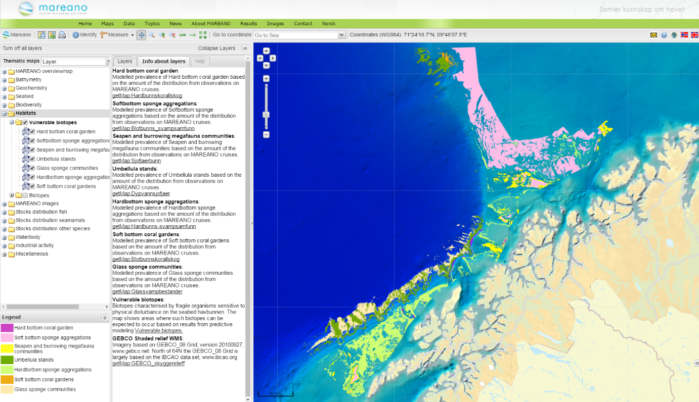
Vulnerable biotope maps
The OSPAR Commission has a mandate to protect and conserve the diversity of the North East Atlantic and in doing so has advanced much of the work on defining which marine (particularly benthic) ecosystems are of international importance. OSPAR refers to all coral communities with relatively high densities of corals as coral gardens and they are collectively considered a type of Vulnerable Marine Ecosystem (OSPAR 2010). MAREANO scientists have largely built on the knowledge gathered by OSPAR in their work to find identify areas where vulnerable biotopes occur, and which may therefore be in need of protection within Norwegian waters.
Through the analysis of MAREANO data, eight vulnerable biotopes have been found in Norwegian waters. Separate models have been created for each one to really understand their distribution and ecology.
Norway's vulnearble biotopes
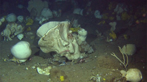
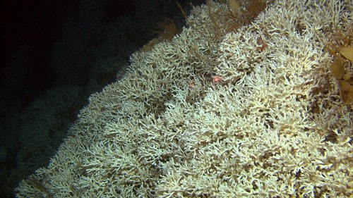
Soft-bottom sponge aggregations
This habitat type is characterized by the concentration of a variety of large sponge species including Geodia spp., Aplysilla sulfurea, Stryphnus ponderosus and Steletta sp. For Tromsøflaket and Eggakanten, MAREANO has found that these sponges are able to modify their environment by creating a thick mat that is a mixture of mud and sponge spicules. Sponge spicules are small, needle-shaped skeleton structures made of silica.
This habitat definition has been refined from the definition provided by OSPAR of “deep-sea sponge aggregations” (OSPAR 2010), which are listed as a type of Vulnerable Marine Ecosystem.
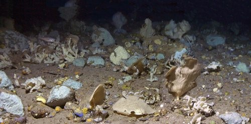
Hard-bottom sponge aggregations
These are communities dominated by erect, medium-sized sponges, typically fan-shaped or branching such as Phakellia spp., Axinella infundibulum, and Antho dichotoma. They occur on different hard seabed substrates (coarse gravel, cobbles, boulders and bedrock). This biotope is generally home to more species, but usually has a lower density of sponges than soft-bottom sponge aggregations.
The habitat definition that we use here has been refined from the definition provided by OSPAR of “deep-sea sponge aggregations” (OSPAR 2010), which are also listed as a type of Vulnerable Marine Ecosystem (FAO).
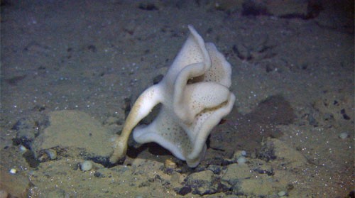
Deep arctic sponge aggregations
This habitat can be described as a type of deep-sea sponge aggregation (sensu OSPAR 2010) occurring only in the deeper, colder water (Arctic modified, and Norwegian Sea Deep Water), where glass sponges (class Hexactinellida) are typical and other strictly deep-sea sponges are common. One of the most common species of glass sponge is the Caulophacus arcticus, which is generally found on hard sea bottoms on the lower part of the continental slope.
Deep-sea sponge aggregations are collectively listed as Vulnerable Marine Ecosystems by OSPAR.
Sublittoral seapen communities
This habitat is included in the OSPAR list of threatened and/or declining habitats, and it is clearly defined here. Within the area covered by the MAREANO programme to date this biotope is home to the seapens Funiculina quadrangularis, Virgularia mirabilis, Pennatula phosforea and Kophobelemnon stelliferum. The Norway lobster (Nephrops norvegicus), squat lobster (Munida sarsi) and sea cucumber (Parastichopus tremulus) are the most common associated megafauna.
Models for this biotope have only been applied to a limited area (namely Nordland VII, Troms II and III, and Eggakanten) within the coverage of multibeam data and sediment maps from the MAREANO programme.
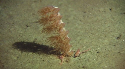
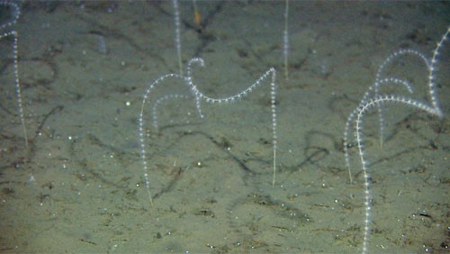
Bathyal seapen communities
In patches, the deep-sea seapen Umbellula encrinus is found in relatively high densities from half way down the continental slope (approximately 800 metres below sea level) and deeper. This large seapen can reach a height of more than two metres. There are often high densities of tube-building amphipods (Neohela) in areas with Umbellula.
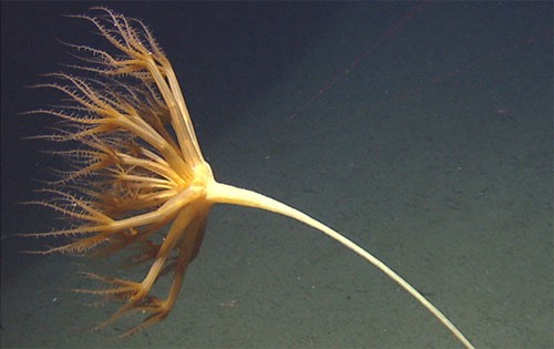
Soft bottom coral gardens
In Norway there are two species of gorgonians that may form dense stands: Radicipes gracilis, and Isidella lofotensis. The sea whip species Radicipes gracilis, also known as pig-tail coral, can form dense stands on sandy muddy (i.e. soft) bottoms. R. gracilis had not been observed in Norway until MAREANO found relatively dense concentrations of this sea whip in the area known as the Bjørnøya slide. This habitat is therefore assed as “Endangered” in the Norwegian Red List of Ecosystems and Habitat types (Artsdatabanken 2018). Isidella lofotensis, is a type of Bamboo coral which is rarely found outside Norwegian waters. It is most common in fjords and has not been frequently observed within the MAREANO mapping area. Thus this species has not been included in modelling the Soft bottom coral gardens.
Hard-bottom coral gardens
Where currents are strong and the sea bottom is hard, we often find sea fan populations that provide habitat for fish, brittle stars and small crustaceans. The most common species of sea fans that make up these hard-bottom coral gardens are Paragorgia arborea, Primnoa resedaeformis, Paramuricea placomus and Swiftia spp. Within the area mapped by MAREANO to date the presence of Swiftia has not been confirmed, and it is more common in relatively shallow waters off Rogaland. Although there is less biodiversity associated with the various sea fans that make up this biotope than with coral reefs, they nevertheless are home to many host-specific species that are not found in other biotopes and generally, contain a remarkable volume of biomass.
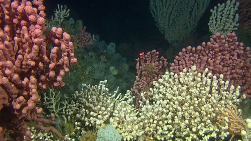
Cold-water coral reefs
Lophelia pertusa (syn: Desmophylum pertusum) is a stony coral which, over a long period of time, can build coral reefs. The Norwegian reefs that have been dated have been found to be 3000 to 9000 years old. Lophelia pertusa can form individual reefs or reef areas where the reefs are so close together that it is sometimes hard to distinguish them. For example, at Hola, MAREANO has mapped a reef area consisting of around 400 individual reefs. MAREANO has also found previously undiscovered individual reefs at Malangsryggen and in the outer part of Malangsdypet. Other stony corals such as zigzag coral (Madrepora oculata), and sea fans such as bubblegum coral and red tree coral increase the spatial habitat complexity and the biodiversity of the reefs. The coral reefs are habitat to a variety of other small and large species, ranging from fish to smaller invertebrates among which some only occur in the reefs.
How are vulnerable biotope maps made?
Only after we are clear on the structure of each biotope (i.e., which are its most representative species), are we in a position to map its geographical distribution. To map the distribution of vulnerable biotopes we use statistical models and geomorphological analysis of bathymetric data. Statistical models are good tools for making predictions and extrapolations; the more field observations you have, the more accurate models become. The catch is that field observations, especially in the deep sea, are expensive, and can be difficult to obtain. Geomorphological analysis of bathymetric data allows to delineate the boundaries of geomorphological features, which in the case of coral reefs, are a good proxy for coral reef distribution. Neither approach is perfect, though, and the resulting maps should be used with due regard for the methods used..
For most of the eight vulnerable biotopes found through the MAREANO Programme we have run two sets of models, one with high detail but limited coverage and another one more recently with less spatial detail but covering a very large area (almost the entire Norwegian part of the Barents Sea!)
The first step is always compiling as many field observations as possible for each habitat. Underwater video is very useful for obtaining the right kind of information. For video-surveyed localities we can obtain very detailed information about whether any of the vulnerable biotopes are present, or really, whether any of their representative species (also called indicator species) are present, as well as how abundant they are. In this approach the density of indicator species is used as a proxy for the biotope.
Then we find the favourable environmental conditions for each group of indicator species. We can only use variables for which we have full-coverage GIS data so that our predictions cover the whole area like a blanket. We have used depth, type of landscape, morphology of the terrain, and characteristics of the sediment, and for the coarse models, oceanographic information. Our models tell us which sets of environmental conditions are favourable for each biotope.
The next step is to find the areas that have similar sets of environmental conditions and get the models to calculate (“predict”) how densely the indicator species may occur. Plotting these predictions on a map results in a so called “heat map” where colour intensity represents abundance of indicator species. Management authorities, however, are often more interested in clear-cut boundaries, which are more useful in marine spatial planning. Therefore, we classify heat maps into categorical classes and discard the low predicted density bins, retaining only the core areas where the models predict the density of indicators species to be highest.
The final maps may look very neat and tidy, but we recommend using them with a small dose of scepticism. Nature does not always behave as expected, or we may not have accounted for all the relevant sources of variation in our data analyses! These maps are best used for guiding dedicated mapping of particular VME areas by literally narrowing down the search area.
In addition to providing a tool to help find places in need of protection, our models have taught us much about the ecology of these communities. For example, the “sponge spicule beds”, also known as ostur in some countries, forms very extensive patches and responds mostly to the size of the grain of the sediment. The species typical for this biotope are typically observed in “soft sediment” (i.e. small grain size) areas.
By contrast, “coral gardens” form smaller patches and seem to be best explained by the morphology of the terrain. They occupy narrow areas on the continental slope where the topography is varied.
Contact

Genoveva Gonzalez-Mirelis
None
None
None
None