Contact
Cruise leader, first leg
Pål Buhl-Mortensen
+47 55 23 6815
+47 974 64 151
Information officer
Beate Hoddevik Sunnset
+47 55 23 85 16
Photos
See photos from the cruise (norwegian pages)
Published: 07.10.2009 Updated: 25.07.2022
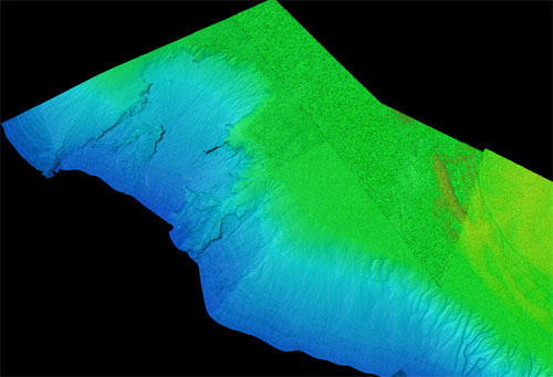
After 15 hour steaming, we arrived at the first location at 1015 m depth in the southern part of the Bjørnøya slide area. Here, we used the new, light fiber-optic cable for the first time. With this cable we will be able to use the tethered video platform deeper than earlier. This will be needed during the second leg where one of the main goals is to map the deep seafloor down to around 2700 m.
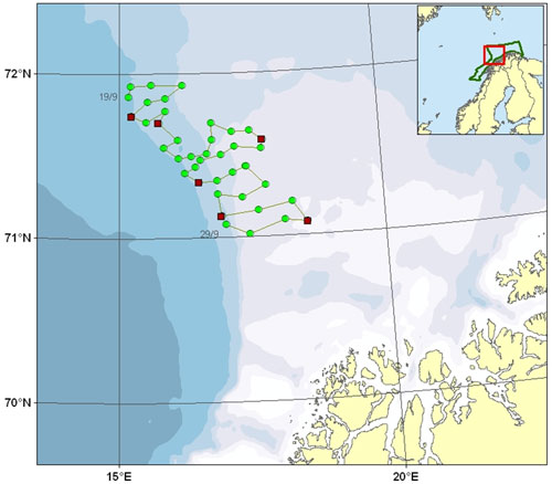
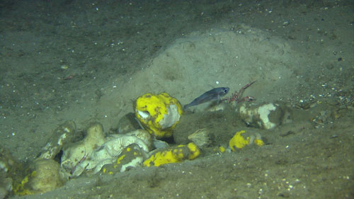
The weather was really variable during the cruise with strong winds and high waves disabeling us from working one third of the time. During eight days of fair weather conditions we surveyed 41 locations with the tethered video platform and sampled the seabed with different gear at six locations. The video platform (Campod) is towed along a 700m distance at each location. At the start and end of each transect we park and perform a careful scanning of the seabed. This scanning enables us to document organisms down to a few mm in size.
The investigated locations of the first leg of the Mareano 2009 autumn cruise cover depth between 1015 and 217 m.
We can, of course only provide more or less anecdotal results at this point. There is a great amount of work effort needed before the detailed scientific results will be in hand from such a cruise.
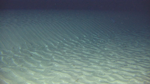
The main patterns however, are clear right away. There is a big difference in bottom type, temperature and faunistic composition related to depth. On the shelf (< ca 400 m) there are many signs of the last glaciation and a great variation in the strength of the bottom currents and sediment types. Here, we find iceberg ploughmarks and almost any type of seabed, with a high diversity of species associated with the Northeast Atlantic water mass. On the shelf in this region we commonly find sponge habitats with a characteristic composition of Geodia spp. Stryphnus ponderosus, Aplysilla sulfurea and Steletta sp. This is a complex habitat with a high associated biodiversity, but the bottom is a nightmare to sample due to the terrible spiny bottom with microscopic needles penetrating your skin if you are not properly protected.
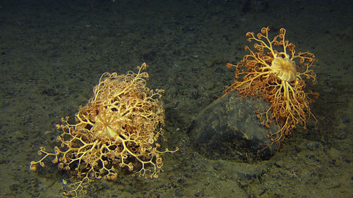
The shelf break (400-500 m depth) is commonly exposed to strong currents where the seabed may consist of gravel or large waves of sand in slow motion. In gravelly bottom in this zone we may encounter meadows of basket stars (Gorgonocephalus sp.). The sandwave areas are more desolated with most sessile inhabitants restricted to small areas of gravel between the heights of the waves.
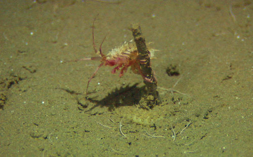
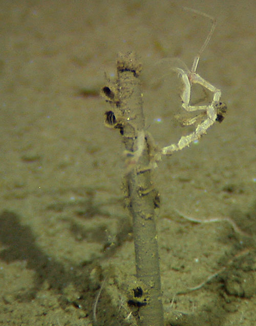
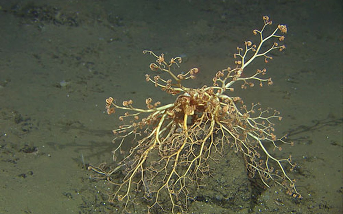
A striking feature of the slope areas below ca 600 m depth (below the border between the warm Atlantic water mass and the colder water masses influenced by the arctic water and the deep Norwegian Sea water mass) was the restricted occurrence of hard bottom with a rich fauna occurring on all erect biota stretching up from the seabed. Almost every tube of bristleworm or any stalk of glass sponge had small crustaceans, hydroids or other life forms using the erect organism to get out of the slow-flowing near-bottom water.
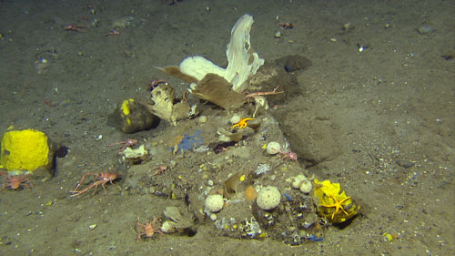
During the recording of video transects, we logged all animals we could recognize, bottom types, and occurrence of human imprints such as garbage, trawl marks and lost fishing gear. The general pattern of trawl mark density versus depth clearly reflected the two major fisheries in the area: white fish on the shelf and Greenland halibut mid-slope.
As mentioned, the next leg of the cruise will investigate even greater depths. This will be off the Vesterålen where the slope is incised by great canyons and where we find the greatest diversity of deep sea landscapes off Norway.