Contact:
Geologist
Sigrid Elvenes
73 90 41 85
Published: 22.02.2013 Updated: 24.10.2019
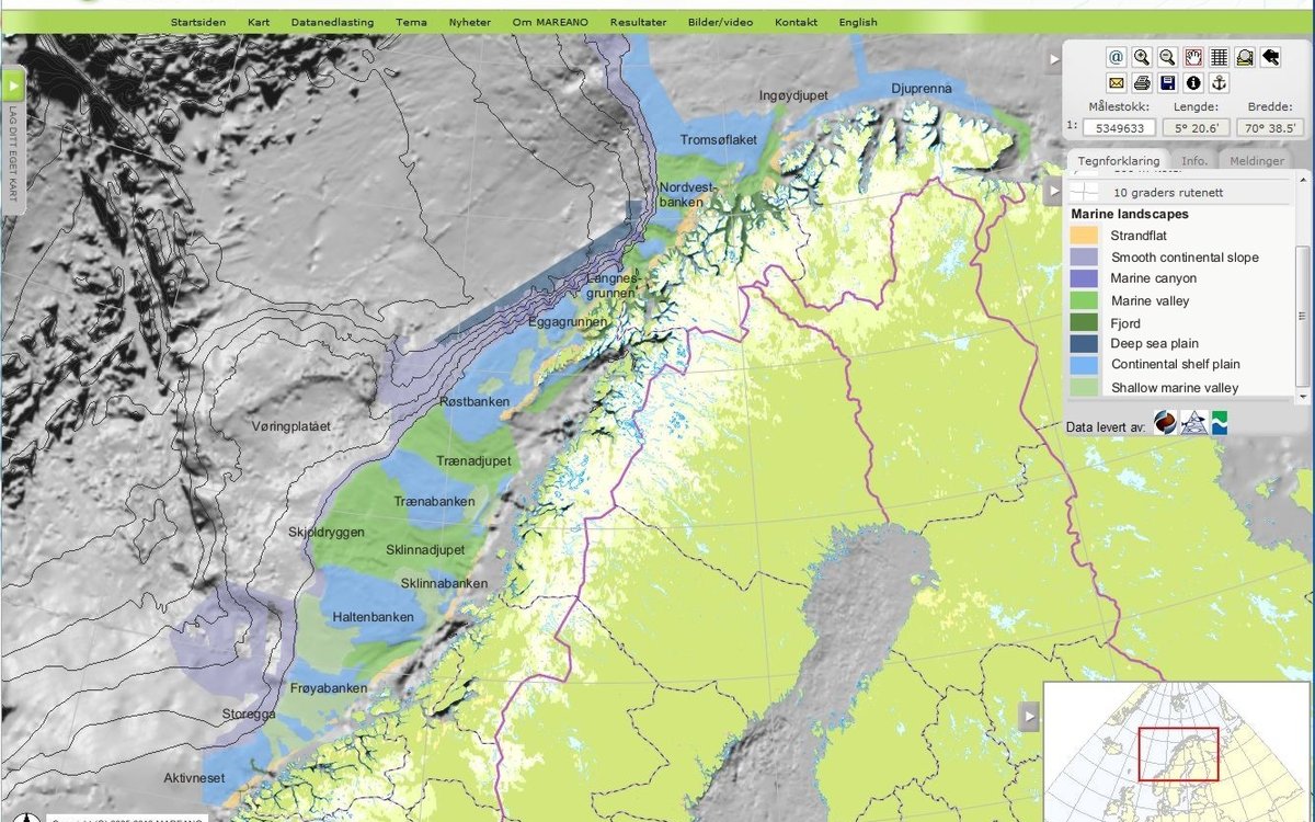
MAREANOs landscape maps now cover large parts of Norway’s marine areas from Møre to Finnmark.
At present, the amount of detailed bathymetry from the mid-Norwegian shelf is limited, but by using coarse bathymetry data compiled from various sources, we can already discern the major features in a diverse submarine landscape of banks, strandflat and wide valleys.
Landscape classification in MAREANO follows the systematic approach developed by “Nature Types in Norway” (NiN, webpage in Norwegian only). Within NiN the term “landscape” refers to major, broad-scale geomorphic features of uniform topography. In order to map landscape types in areas where detailed bathymetry surveys have not yet been carried out, we look to we look to alternative data sources. 3D-seismic data from hydrocarbon exploration and compiled single-beam echosounder data from fishing vessels are put to use as supplements to MAREANO’s multibeam bathymetry, thus providing sufficient basis for broad-scale mapping.
The newly published landscape classification for the mid-Norwegian shelf marks an addition of 120 000 km2 to MAREANOs landscape map. This doubles the total coverage of this map product in Norwegian marine areas.