Cruise diary: MAREANO continues its mapping of Spitsbergenbanken and takes a closer look on some of the landforms made when the bank was covered by a thick glacier.
Published: 23.09.2021Updated: 28.09.2021Author: Ingrid Leirvik Olsen, Reidulv Bøe, Valérie Bellec and Aivo Lepland, Geological Survey of Norway, and Børge Holte, Institute of Marine Research
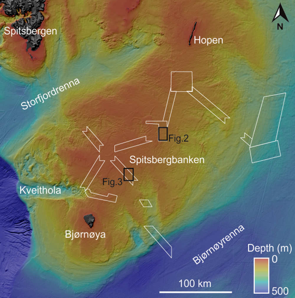
Spitsbergenbanken, a shallow marine bank at 25-250 meters depth in the Barents Sea (Fig. 1), was covered by a more than two kilometers thick glacier during the last glacial period. Many of the landforms were formed as the ice retreated.
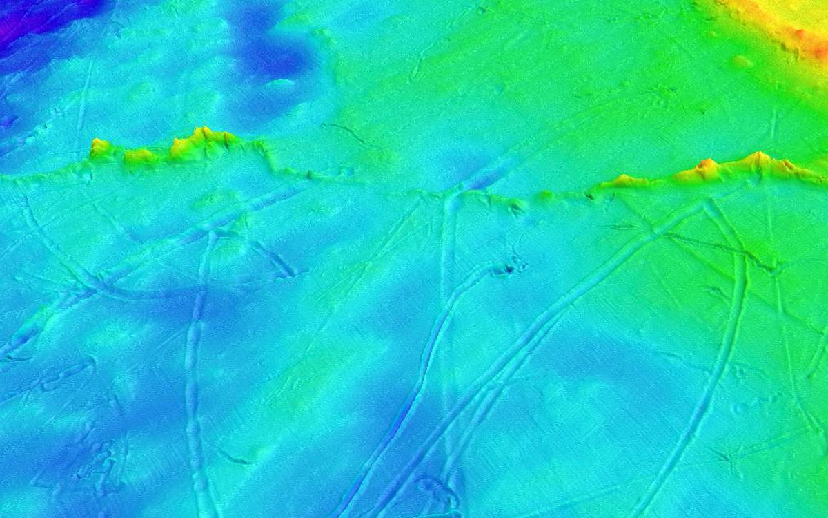
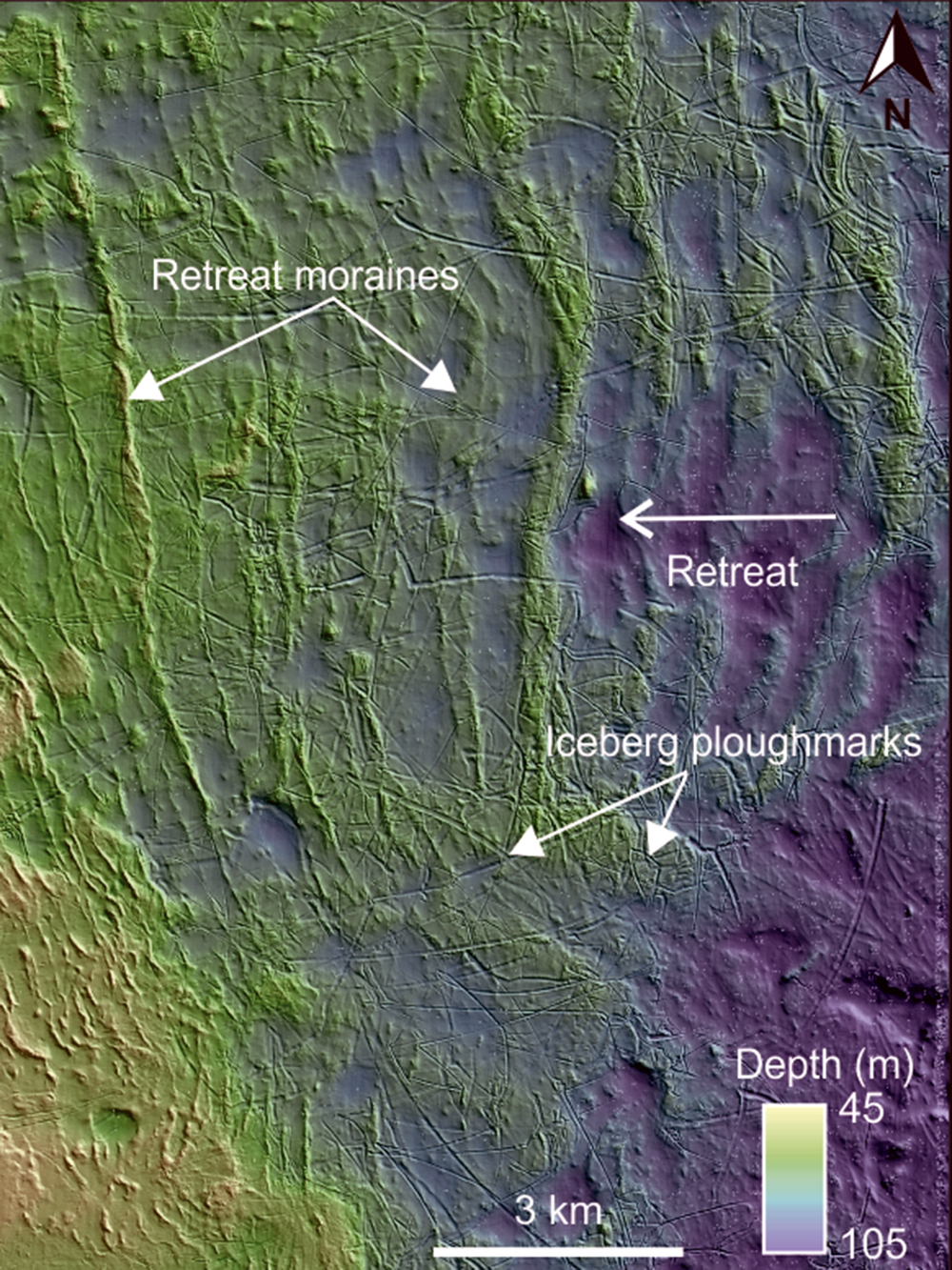
Figure 1: An overview map of Spitsbergenbanken. White boxes show the mapping locations for this year’s third Mareano cruise, in addition to the locations of figure 2 and 3.Figure 2: Shaded bathymetry map of a central area on Spitsbergenbanken showing retreat moraines and iceberg ploughmarks. White arrow indicates the direction of ice front retreat. In this area of the bank, the moraine ridges are oriented north to south, indicating that the ice front retreated towards west. The iceberg ploughmarks show no preferred orientation.
Elongated, parallel ridges of moraine material are common features on Spitsbergenbanken (Fig. 2). These ridges were formed as the ice thinned and retreated towards the end of the last glacial period. We don`t know if each ridge represents one year, tens or hundreds of years of stillstand, but this is something we can study more closely. In this area of the bank, the moraine ridges are oriented north to south, indicating that the ice front retreated to the west, towards the shallowest areas of the bank.
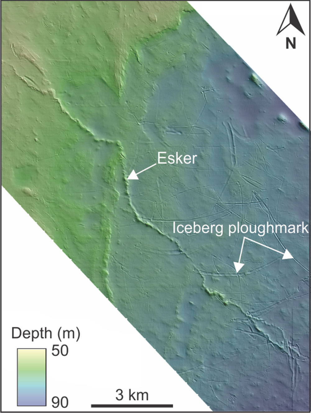
Iceberg ploughmarks cut through moraine ridges and into the seafloor (Fig. 2 and 3). After calving from the glacier front, drifting iceberg keels ploughed the seafloor sediments, driven primarily by ocean currents. The iceberg ploughmarks on Spitsbergenbanken are more than ten kilometers long, one kilometer wide and ten meters deep.
Figure 3: Shaded bathymetry map showing an esker and iceberg ploughmarks on Spitsbergenbanken. The esker is 17 kilometers long and up to eight meters high.
Another prominent landform on the seafloor is elongated, sinuous-shaped ridges called eskers (Fig. 3). These ridges consist of coarse sediments, like sand and gravel, and were formed as a result of sedimentary infill within meltwater channels within or under the ice when a large glacier covered the area.
Vi kartlegger havbunnen – vil du vite hva vi finner?
Da kan du melde deg på årets Mareano-konferanse. Her får du helt oppdatert kunnskap om nye spennende funn – og du får vite litt om hvordan du kan bruke dataene i ditt eget arbeid.
Årets konferanse blir digital og gjennomføres 21. oktober.