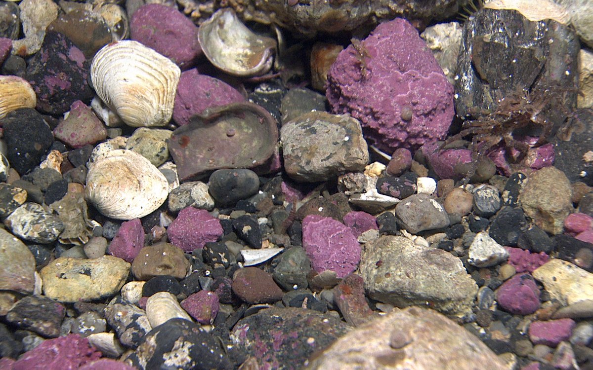
Cobbles and boulders with some gravel in between. Here the stones are coated by the encrusting algae (Lithothamnion sp.), giving them a vivid purple colour. 10 cm between red dots. (Photo: MAREANO/HI)
Photo: MAREANO/HI
Cobbles and boulders with some gravel in between. Here the stones are coated by the encrusting algae (Lithothamnion sp.), giving them a vivid purple colour. 10 cm between red dots. (Photo: MAREANO/HI)
Photo: MAREANO/HIPublished: 30.10.2019 Updated: 26.09.2022
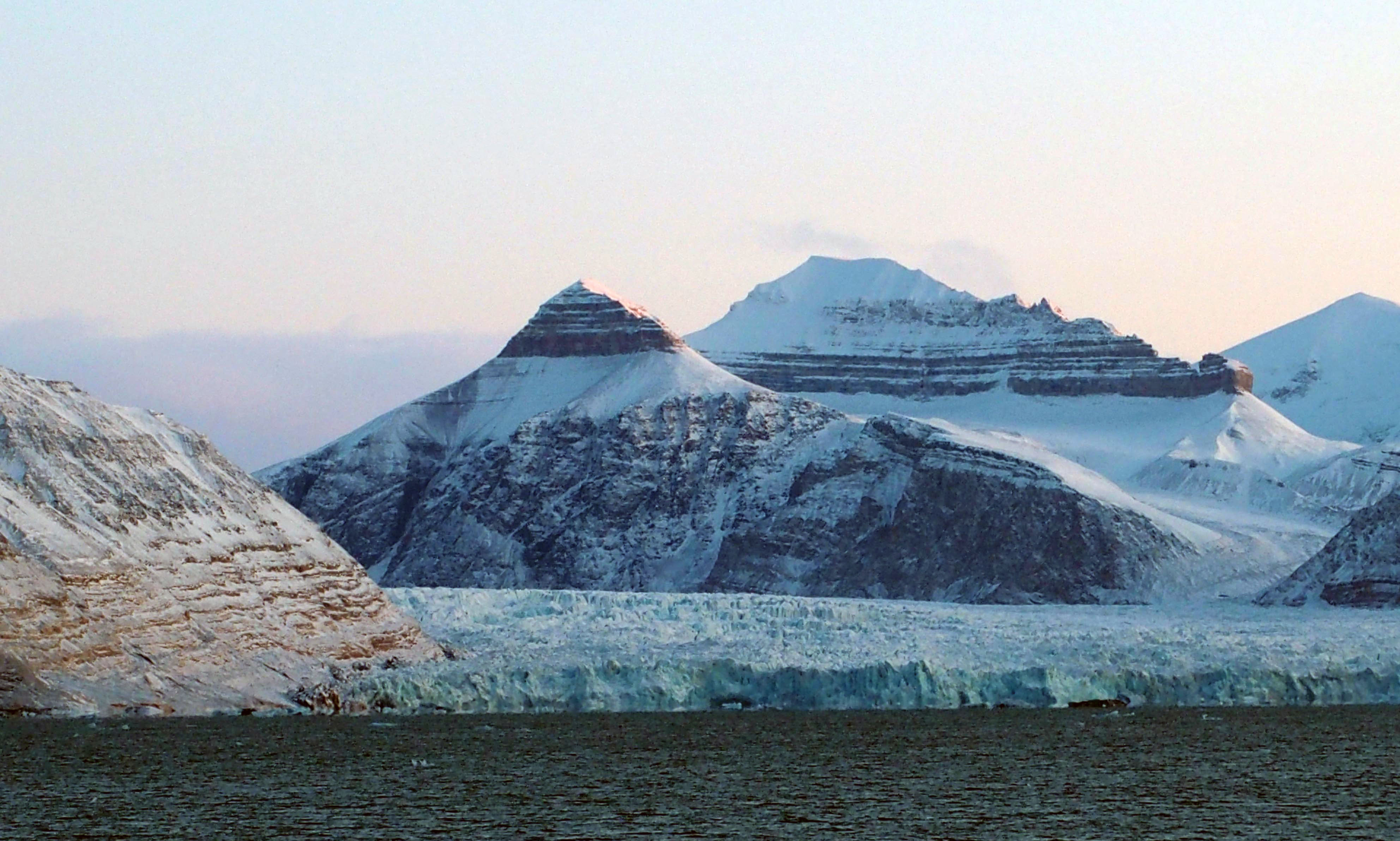
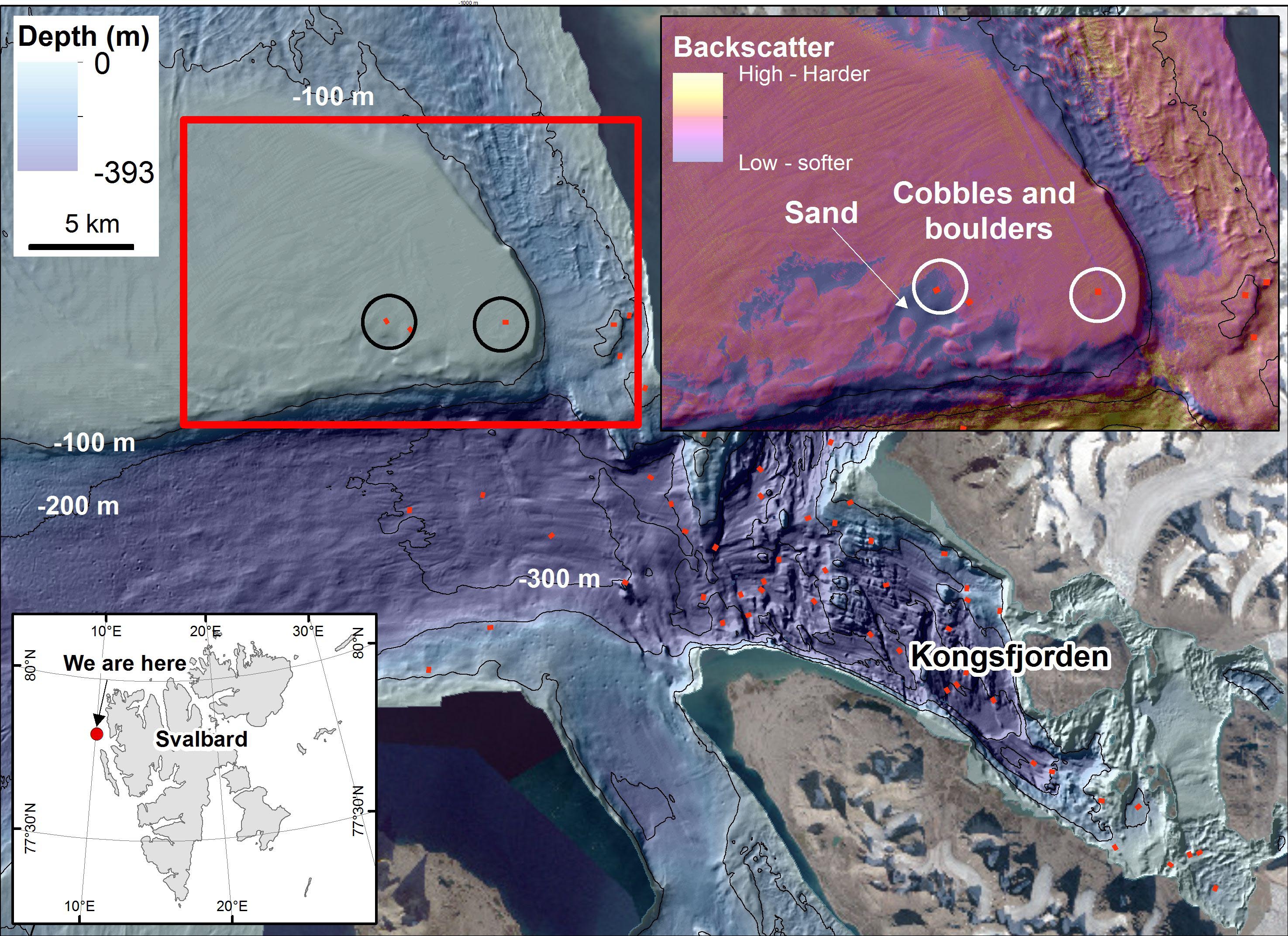
After seeking shelter in beautiful Kongsfjorden during a spell of bad weather, we returned out to the open sea. Some of the transects that we acquired video data along were located on a shallow bank, only 30 m depth at the shallowest.
Such shallow depths are prone to strong currents and waves can easily erode the seafloor, meaning that mostly all fine-grained sediments are washed away, leaving only a cover of very coarse sediments (gravel, cobbles and boulders; see photos below). The light can also reach the seafloor, allowing algae to thrive on the stones.
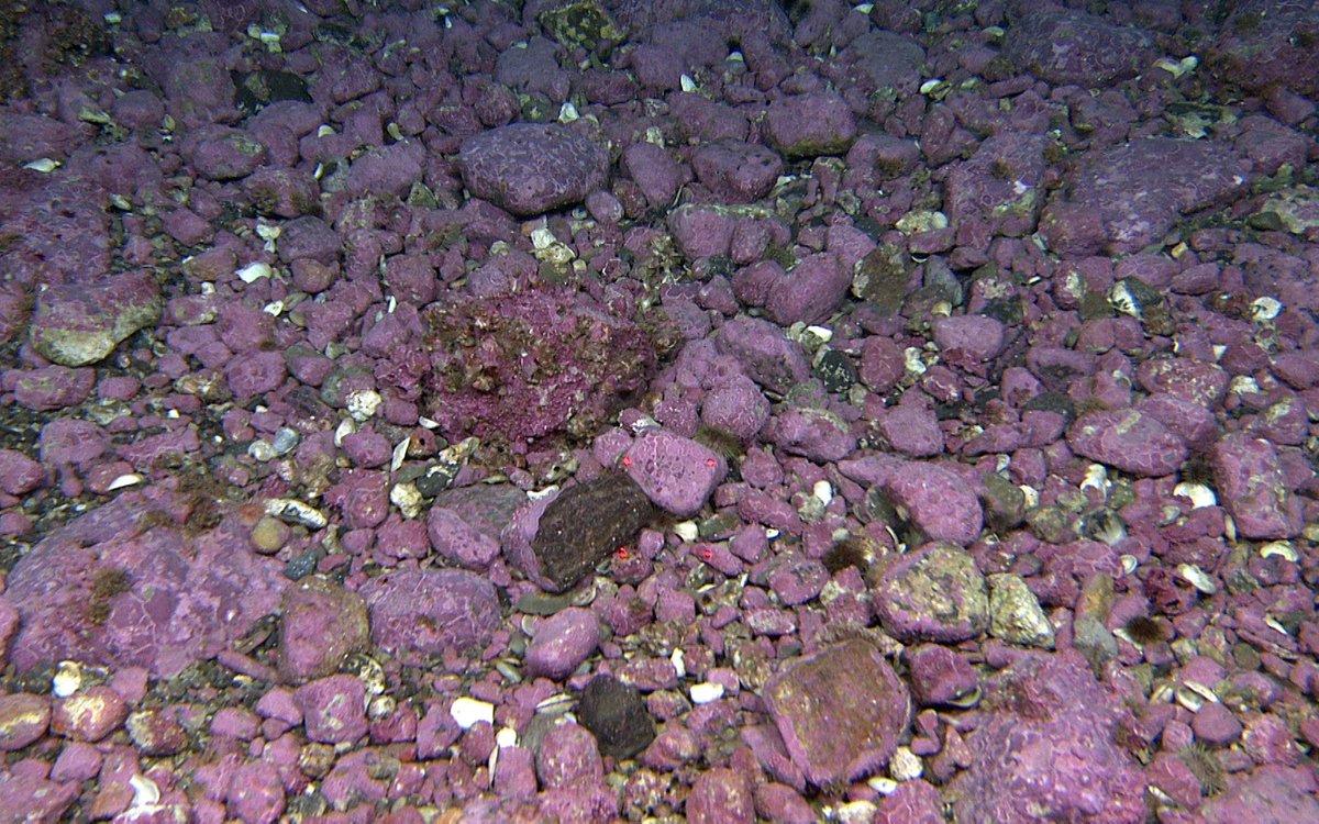
Cobbles and boulders with some gravel in between. Here the stones are coated by the encrusting algae (Lithothamnion sp.), giving them a vivid purple colour. 10 cm between red dots.
Photo: MAREANO/HI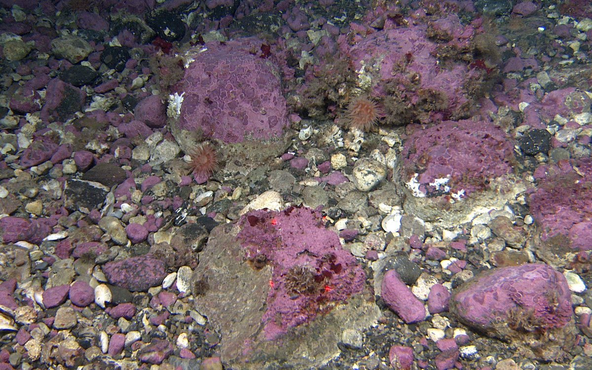
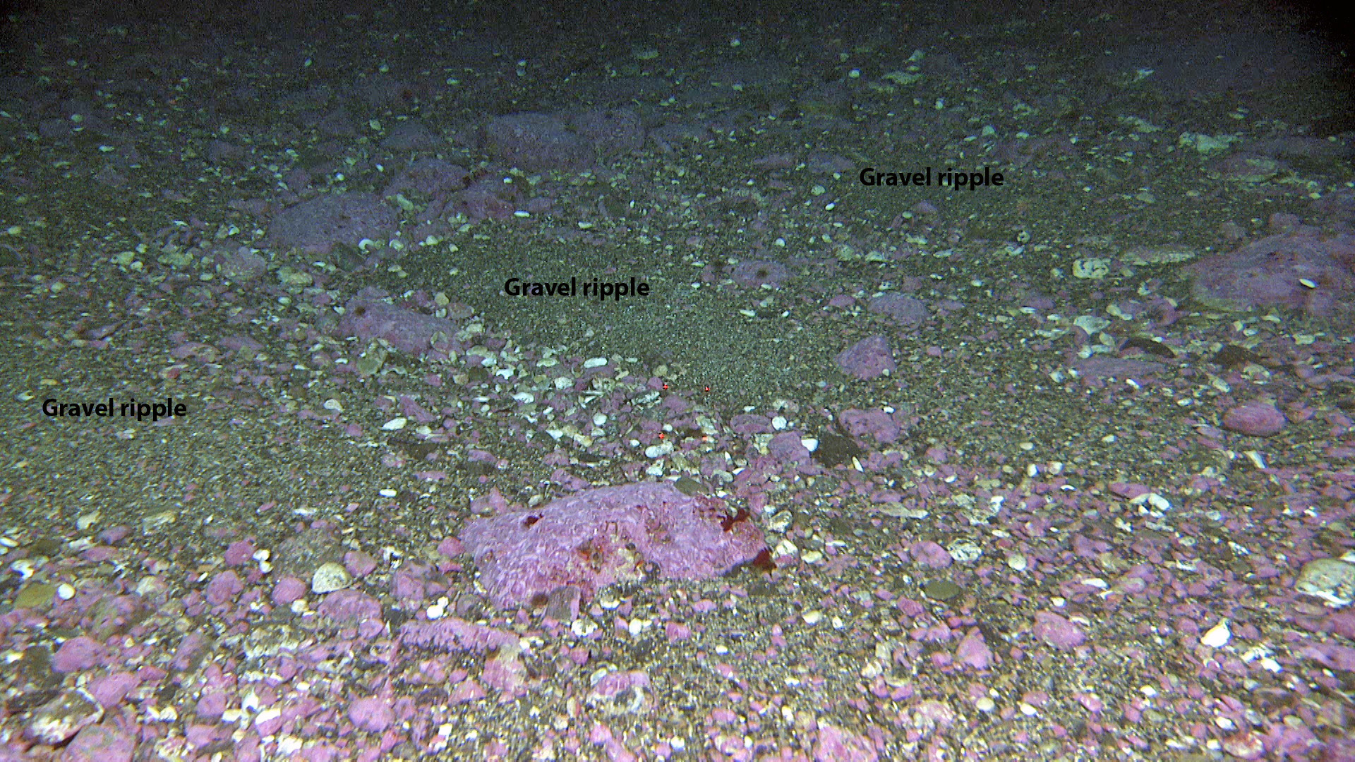
It is common to see a clear gradient from coarser to finer sediments when moving into deeper and calmer areas. This reflects the decrease in current strength, and the sediments are often well sorted (by grain size). We see this here, a little deeper, where the currents are slightly weaker. This allows sand deposition in small basins. Nevertheless, the currents here are strong enough to form asymmetric ripples, where the steep slope (lee side) points down-current.
Sand accumulation in small basins.
Photo: MAREANO/HI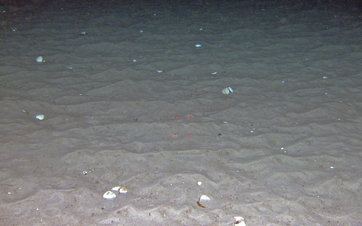
Strong currents allow sand ripples to form. 10 cm between red dots.
Photo: MAREANO/HI