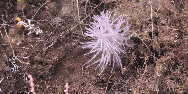
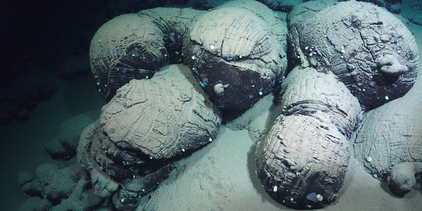
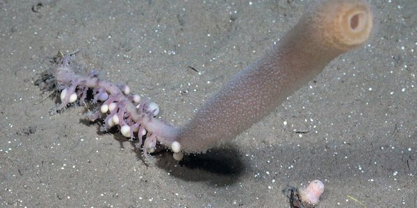
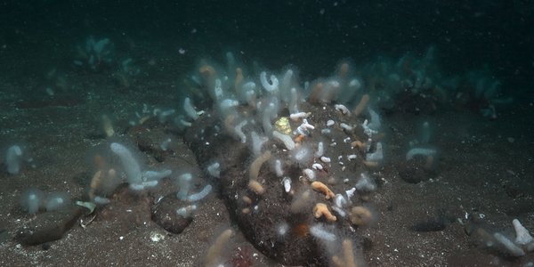
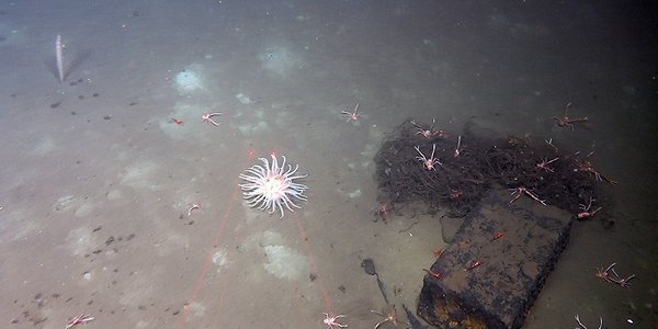
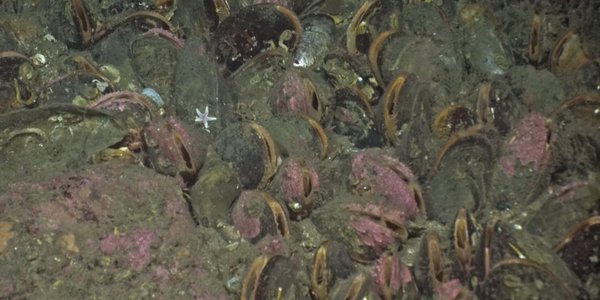
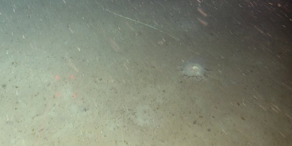
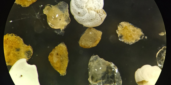
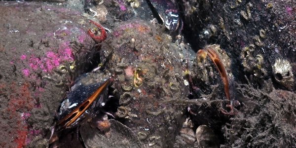
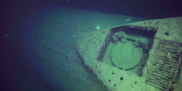
New measurements of hydrocarbons The maps with the levels of hydrocarbons are now updated with the results from the 23 locations investigated in 2010. Same as before, the levels are low at all the places where sampling was carried out. [16 Jan 2012 11:31] |  |
|
|
MAREANO presented in Portugal Bio-prospecting and benthic mapping were highlighted during the conference “On the exploration and utilizing the resources of the sea” that was arranged in historical environments in Lisbon on Wednesday Dec 14. MAREANO was among the invited speakers. [19 Dec 2011 10:50] |  |
|
|
Tracking the environmental state of the seabed using bottom sediments in the area west of Lofoten Modern environmental state and its recent changes can be assessed by studying successions of fine-grained sediments accumulating in shelf basins experiencing very weak or no current. Low current in such basins facilitates continuous deposition, a few millimeters per year, of mud and organic remains that are the main carriers of contamination in the marine environment. [22 Sep 2011 12:48] |  |
|
|
New sea spider found in Norwegian waters The sea spider Cilunculus battenae was recently recorded in the Norwegian Economic Zone (NEZ) for the first time, when bottom samples from the MAREANO cruises from 2007-2009 were analysed. So far 21 different species have been found in the samples. Two species have previously been observed in the NEZ a few times. [15 Sep 2011 12:43] |  |
|
|
|
|
"G.O. Sars" discovers geological secrets During a 500 km long transit from Troms III to Nordland VI the MAREANO project has acquired new data from the upper sediment units. We applied Topas, a kind of strong echosounder sending signals at regular intervals into the seafloor. [01 Oct 2010 10:24] |  |
|
|
|
|
|
|
Successful MAREANO summer cruise comes to an end This summer’s MAREANO cruise with research vessel “G.O. Sars” ends today in Tromsø, with no time lost due to bad weather or equipment problems we have been very lucky, and have completed all the planned work, and a few extras. The Troms III area offshore north Troms (north Norway) has been the focus of the second leg of the cruise, continuing the good work begun in the first leg. Following video surveys over several previously undocumented coral reefs during the first leg, right at the end of the second leg we were lucky enough to encounter yet another reef, around 20 km north of Vannøya. [13 Aug 2010 14:55] |  |
|
|
News and pictures from the MAREANO summer cruise 2010 A quick note from all on board the Norwegian research vessel ‘G.O. Sars’. We are making good progress with the first of two MAREANO cruises to be undertaken this year, and are now mid-way through the second and final leg of this research cruise. [10 Aug 2010 10:42] |  |
|
|
Mapping the sea floor north of Nordkapp During the summer cruise of 2010, MAREANO completed mapping of a 150 km long and 16 km wide transect on the Nordkappbanken. During three days, R/V "G.O. Sars" made video recordings of the seabed at a total of 18 stations, and the sea bed was sampled with different types of equipment at four stations. Water depth in the mapped area ranges from 230 m to 315 m. [10 Aug 2010 10:40] |  |
|
|
A general nature-type map for Eggakanten Mapping the distribution of seabed nature types is an important component of MAREANO. Nature types follow, and contribute to the development of the Norwegian Nature Types classification scheme at the nature-system level. [08 Mar 2010 14:20] |  |
|
|
Preliminary results from MAREANO cruises in 2009 The MAREANO mapping in 2009 at the “Eggamargin” and in “Nordland VII” off Vesterålen/Lofoten is now completed. Altogether 129 localities were investigated during two 3 week long cruises conducting 132 video-transects (700 m long each) and 26 sampling stations. [17 Dec 2009 15:19] |  |
|
|
2700 metres below sea level Blue holothurians (sea cucumbers) amongst sea lilies together with brilliantly red shrimps and irregular sea urchins were just some of the astonishing creatures that scientists observed when they earlier this autumn they explored the sea bottom down to 2700 metres depths in Nordland VII, an area off the coast of Northern Norway. [14 Dec 2009 10:44] |  |
|
|
Investigating the Norwegian continental shelf and deep slopes in the arctic R/V G.O. Sars left Tromsø harbour 18 September with steady course heading for the “Eggakanten”, the continental shelf break northwest off the Norwegian mainland, approximately half-way to the Bear Island. The mission was to map the seabed as part of the Norwegian mapping programme MAREANO. The cruise is divided in two legs; the first, which we report from here, was undertaken between 18 and 30 September and the second leg which runs from 30 September until 11 October. Onboard were 14 scientists and technicians within the fields of marine taxonomy, geology and chemistry. [07 Oct 2009 11:31] |  |
|
|
New articles from MAREANO In the beginning of August (2009) the Norwegian Journal of Geology published a thematic issue with 15 new articles mainly based on results from MAREANO. [19 Aug 2009 12:46] |  |
|
|
The April 2009 MAREANO cruise Scientists from the Institute of Marine Research (IMR) and the Geological Survey of Norway (NGU) have started the April 2009 MAREANO cruise (2009105) aboard the "G.O. Sars". The scientific crew includes Norwegians, French, Danish, Canadian, German, Faroese and Finnish. The northernmost study area is located on the continental shelf, approximately 195 nm north of the Norway coast. The 9000 km2 large study area, covered by the cruise, includes depths ranging from 300 to 1000 meters, and will be mapped for benthic fauna, bottom types and environmental status. [17 Apr 2009 10:06] |  |
|
|
Biodiversity at great depths The Norwegian seabed mapping programme, MAREANO, has just finished its fourth cruise off northern Norway with the research vessel G.O. Sars. The target of this cruise is deeper slope areas off the counties of Troms and Nordland. The investigation covers several very different marine landscapes including submarine canyons, coral reefs, moraines, sand dunes and consolidated clay with rough topography. [25 Jun 2008 13:37] |  |
|
|
Exciting observations in 2007 The MAREANO mapping in 2007 was characterised by dramatic sceneries and exciting observations from different seascapes. The spring survey covered remaining parts on the Tromsøflaket fishing bank, while the autumn was spent in the management areas of Troms II and Nordland VII. Gas vents, new coral reefs and rich biological communities were documented, and for the first time the equipment was tested in deep waters. [23 Apr 2008 15:31] |  |
|
|
Glimpses from life 300 metres below the surface Getting a bright light in the face and being filmed doesn't happen every day to the creatures at the bottom of the Barents Sea. Here are some highlights from the mapping survey conducted last month by scientists in the MAREANO programme. [27 July 2006] [30 Jan 2007 22:12] |  |
|
|
Unique images from the deep Copulating octopuses, feeding hermit crabs, squat lobsters and tiny crustaceans, sponges of all shapes and colours: IMR scientists are ecstatic about the fantastic images their high-definition camera has brought up from the deep during a four week long survey in the Barents Sea. Never before have they been able to watch life unfold on the seabed of the Arctic in such great detail. [23 June 2006] [30 Jan 2007 22:12] |  |
|
|
The seabed in Norwegian waters to be mapped Norwegian waters cover a total of over 2 million km2. As of today, the knowledge about the seabed in our waters is limited. In fact, we know far more about the surface of the planet Mars than about the seabed right outside our coastline! In 2005, the Norwegian government allocated NOK 5 million for the first phase of an interdisciplinary programme, MAREANO, which aims to map and study the seabed in Norwegian waters – initially focusing on environmentally sensitive areas of the Barents Sea. [14 Feb 2006] [30 Jan 2007 22:12] |  |
|
|