Contact
Anne Helene Tandberg
cruise leader
Beate Hoddevik Sunnset
communication advisor
+47 908 21 630
Published: 28.08.2014 Updated: 02.11.2022
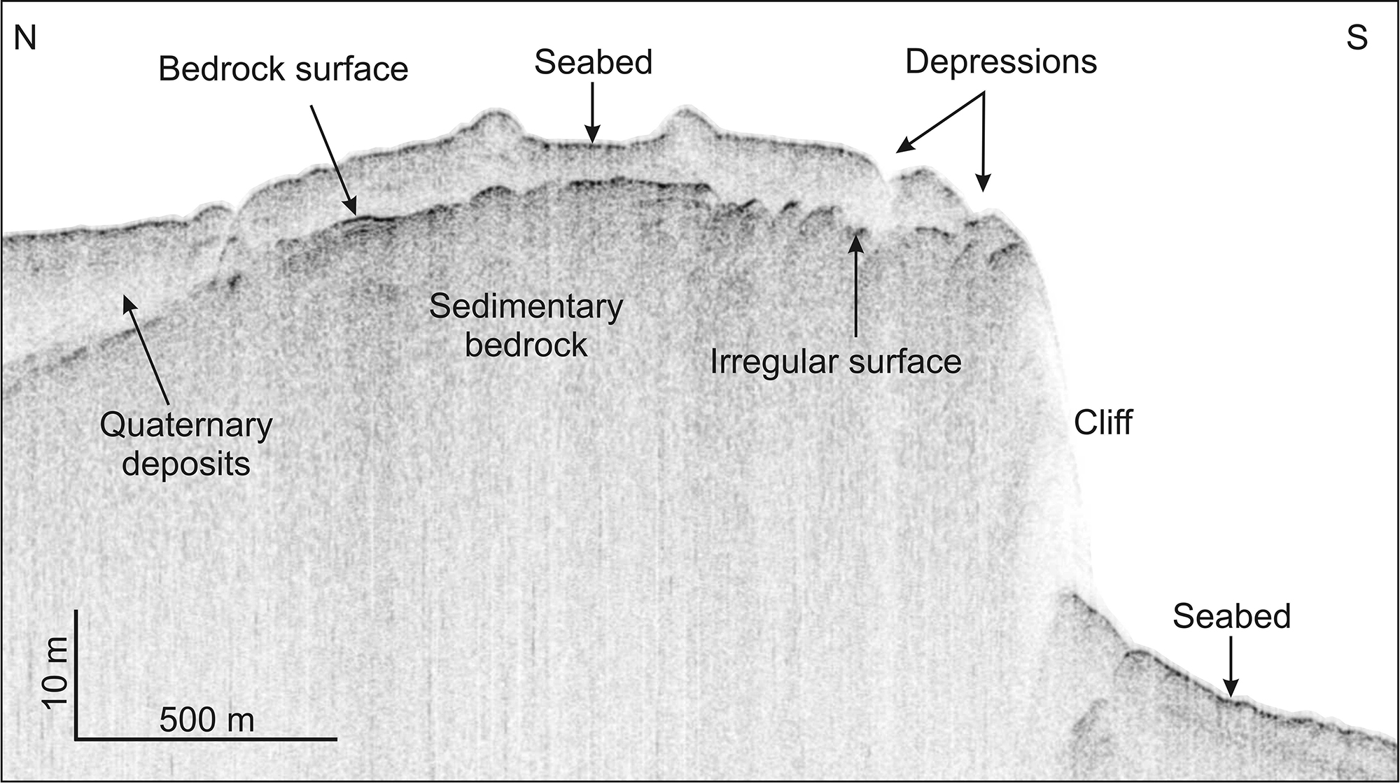
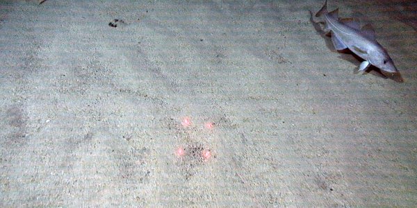
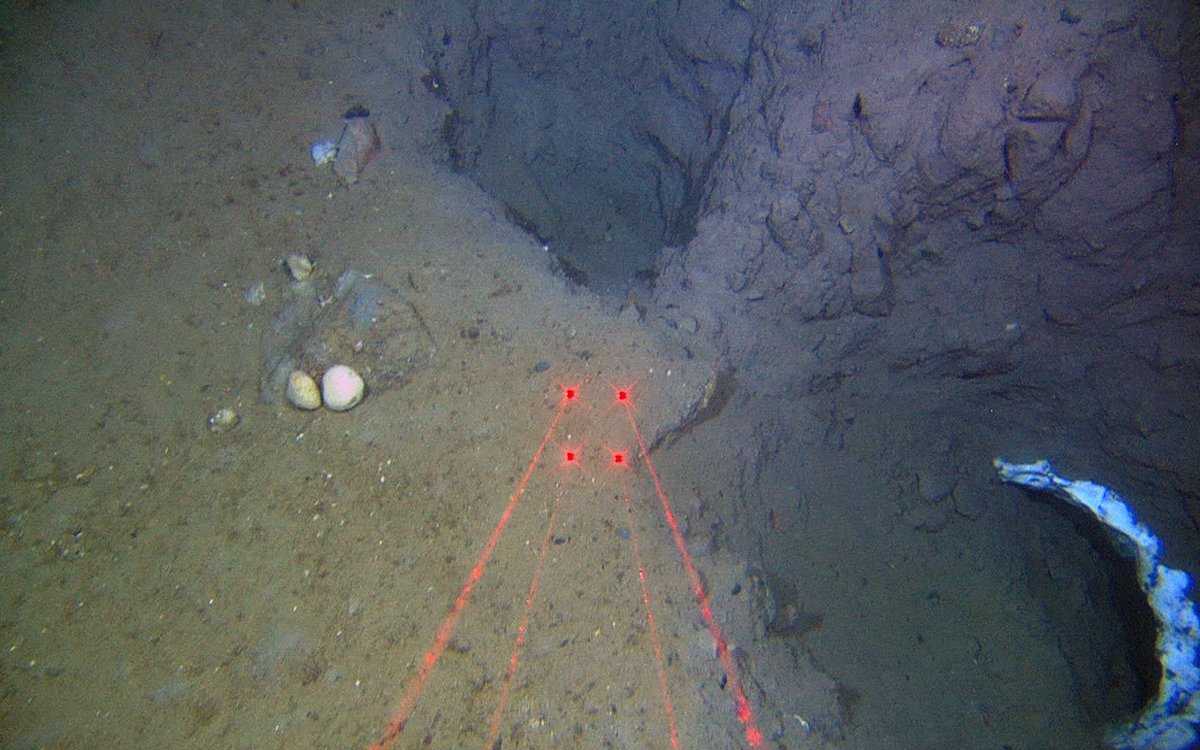
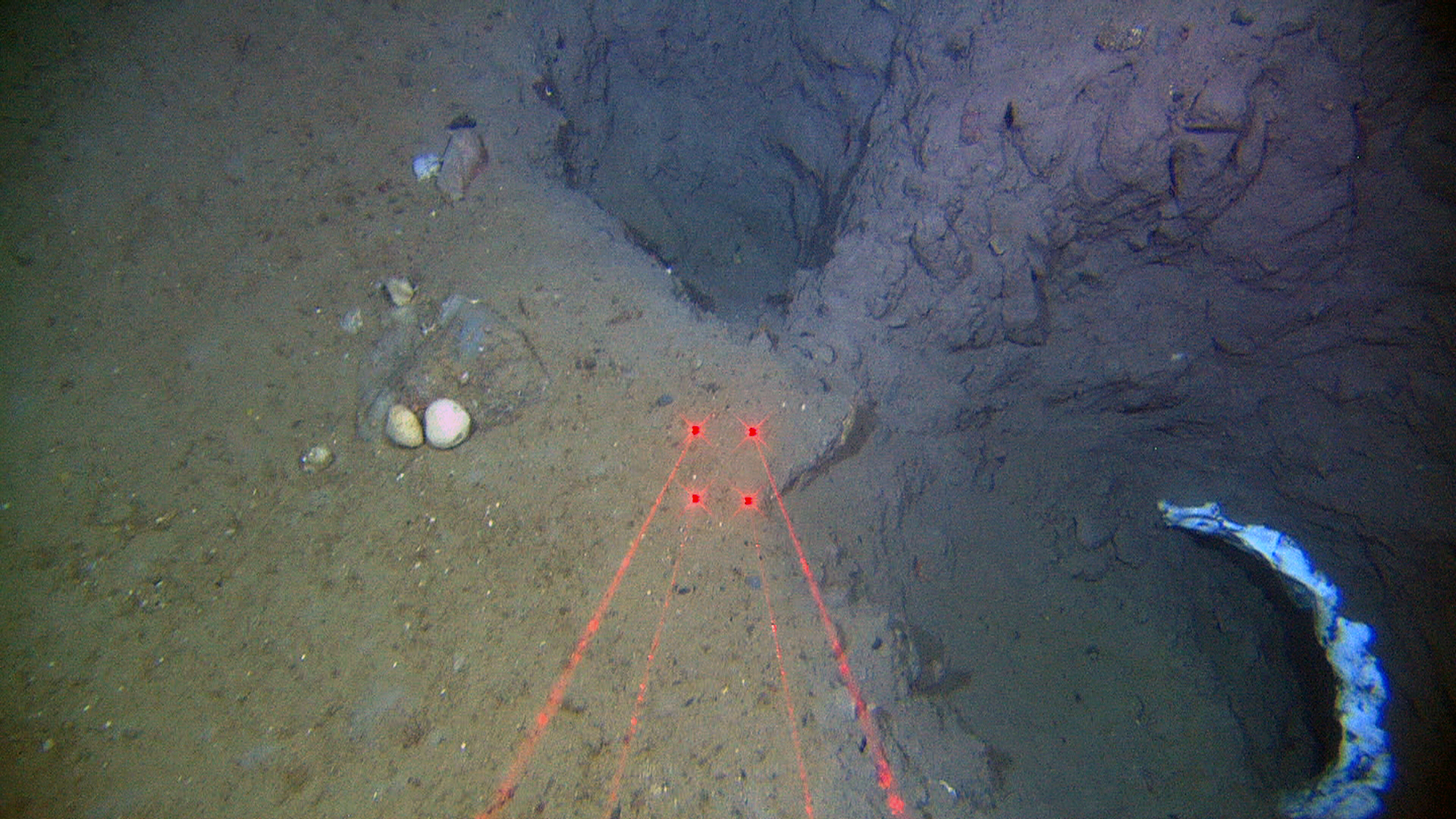
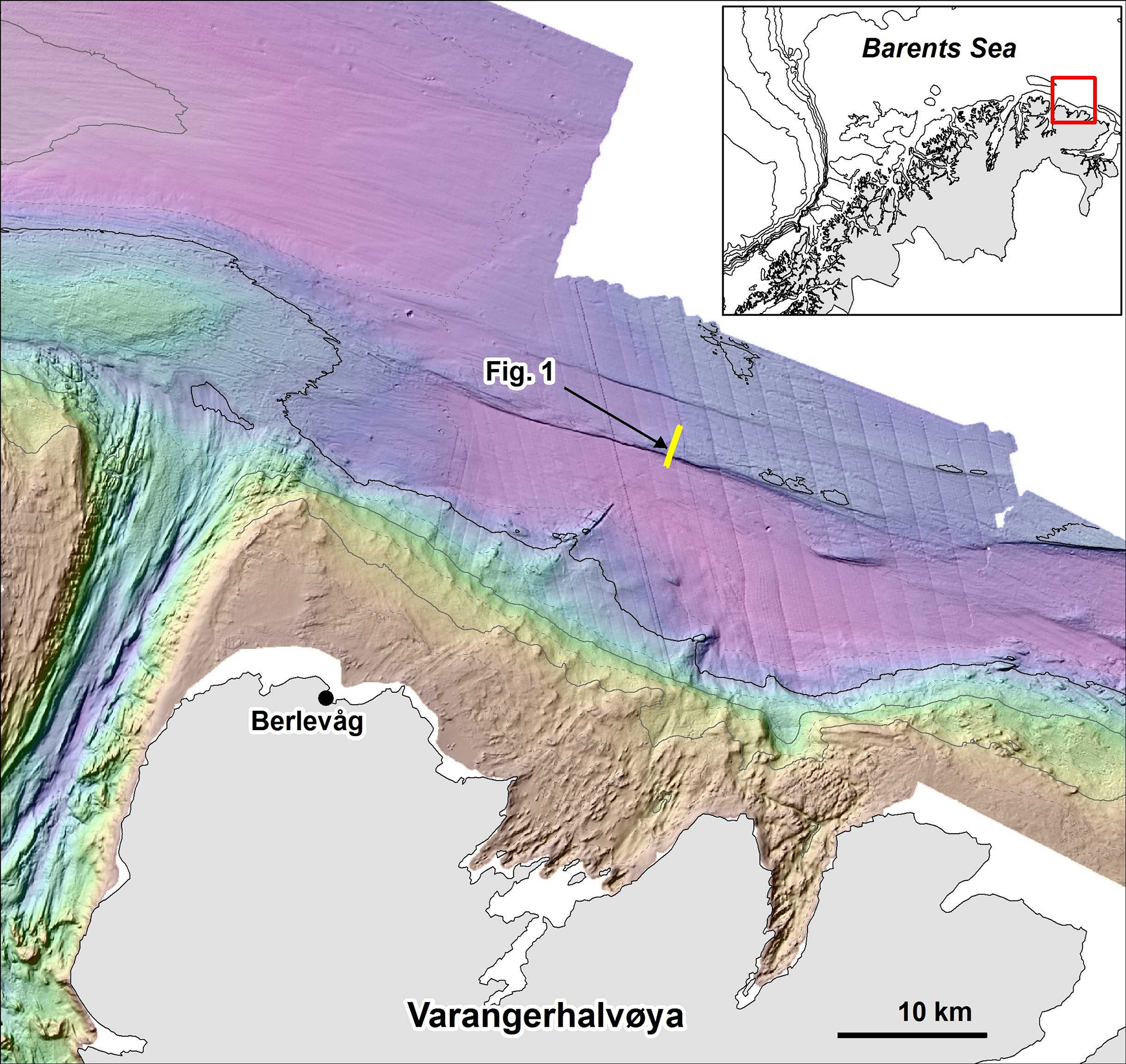
The holes are 1-2 metres wide and 2-3 metres deep, occurring above of and directly north of the cliff face (Figs. 1 and 2), just south of two depressions up to 100 metres wide that can be seen in multibeam bathymetry data. The white features occur on the sediment surface at the bottom of the holes and in the depressions.
In 1987 and 1988, IKU Petroleum Research cored the bedrock succession on top of this ridge (Bugge et al. 1995, Norsk Geologisk Tidsskrift 75), around 6 km further east. They interpreted the sedimentary succession as Upper Carboniferous in age (~ 300 million years old). The rocks in the upper part of the bedrock ridge are dominated by carbonate rocks and evaporites formed by evaporation of salt water.
Looking at the TOPAS line in Figure 3, we see the layering of the sediments below the seabed. It appears that one of the layers terminating at the seafloor near the brink of the steep cliff is very irregular. This could be an old karst surface in carbonate rocks. The surface may however also be related to erosion processes during the last ice age when large glaciers covered the area.
The presence of the holes in the seabed immediately above this irregular surface may well be connected. It is possible that the seabed has collapsed due to karst (dissolution of carbonate rocks) in the layers below, just like sink holes in Florida and Guatemala open and swallow houses, cars and people. Karst surfaces have been described within these layers. The holes may also be related to seabed collapse due to near surface fault movements.
The origin of the white material remains to be investigated. One possibility is that the material represents salt or evaporite, eroded from the nearby bedrock and incorporated in the Quaternary deposits. Another possibility is that the white material is sponges growing on the sediment wall. A third possibility is gas hydrates, although it is unlikely that these would be stable at the seabed in this region. These holes and the white material will be further investigated in future projects.